
Port Aransas by Boat: Ramps, Marinas, Tides and Fishing
Planning a boat trip to Port Aransas, Texas? Public ramp, marinas, tides, the ship channel and jetties, the 9-mile state waters line and the license you need.
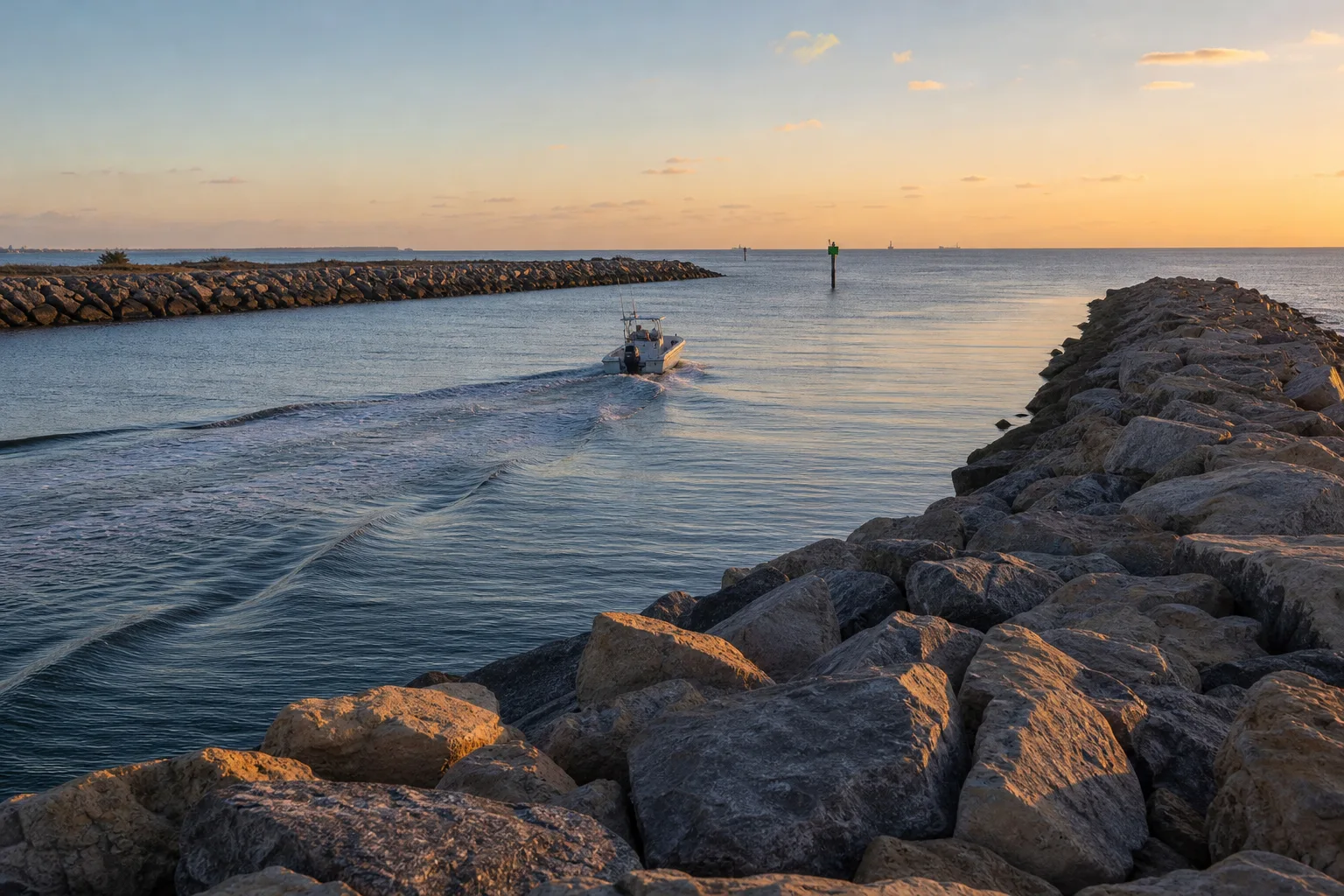
Port Aransas sits on the north tip of Mustang Island, Texas, where the Gulf of Mexico meets the bays through Aransas Pass. Marinalo data (October 2026) lists one public boat ramp in the town, Robert's Point Park on the Corpus Christi Ship Channel, plus two marinas, and most boaters head out through a jettied pass that is also a working shipping lane. Plan around the tide, give ships plenty of room and carry a Texas fishing license with a saltwater endorsement if you plan to fish.
This guide covers the ramp and marinas, the pass and its jetties, tides, where Texas waters end and federal waters begin, and what you need to fish legally. Where we could not confirm a detail from an official source, we say so and tell you who to call.
Port Aransas at a glance
| Item | What Marinalo data shows (October 2026) |
|---|---|
| Public boat ramps | 1: Robert's Point Park Boat Ramp, listed on the Corpus Christi Ship Channel, saltwater (source: TPWD Public Boat Ramps) |
| Marinas | 2: Island Moorings Yacht Club & Marina and Port Aransas Marina, both with rates on request |
| Fuel docks listed | 0 on the Marinalo marina page; call ahead before you count on fuel |
| Tide chart | Daily predictions from NOAA harmonic constants |
See the full lists on Marinalo: boat ramps in Port Aransas, marinas in Port Aransas and the Port Aransas tide chart. For fuel around the state, use the Texas fuel docks directory, and for the wider picture see all Texas boat ramps.
Launching: one ramp, so go early
With a single public ramp listed in town, expect a line on summer weekends and holidays. Marinalo's page does not show lanes, fees or parking for it, so call the city before you tow in, or check the TPWD public boat ramp inventory it is built from. A few habits save time at any busy ramp: load gear and set the drain plug in the parking area, not on the ramp, and move your trailer out as soon as the boat is floating.
If you are towing a boat you have not hauled before, check your numbers first with our guide to boat towing capacity.
Marinas and slips
Marinalo lists two marinas in Port Aransas: Island Moorings Yacht Club & Marina (+1 361-749-4100) and Port Aransas Marina (+1 361-749-5429). Neither has a published rate sheet in our data, so slip and transient prices are "rates on request" and you will need to call. To see what slips cost elsewhere on the coast, read our Texas boat slip prices breakdown or browse 40-ft slip prices in Texas.
Aransas Pass, the jetties and the ship channel
Aransas Pass is a natural tidal inlet between Mustang Island and San Jose Island. The Texas Bureau of Economic Geology describes the south jetty as running about half a mile out from the north tip of Mustang Island, built to stabilize the entrance to the Corpus Christi Ship Channel, with construction starting in the 1880s. That channel carries large commercial ships to the Port of Corpus Christi, and the Port Aransas ferry crosses it.
What that means on the water:
- Ships cannot stop or turn quickly. Federal navigation rules say a vessel under 20 meters long (about 65 feet) must not impede a vessel that can safely navigate only within a narrow channel (33 CFR 83.09, Rule 9). If you are in a small boat, stay out of the way and cross the channel quickly and at a right angle, not at a slant.
- Do not anchor or drift in the channel. Fish outside the marked channel edges.
- Watch the ferry. It crosses the channel continuously, and the Coast Guard investigated a close approach between an LNG carrier and a loaded ferry at Port Aransas in 2019, a reminder that big ships and crossing traffic share tight water here.
- Tide and wind in a pass. Water moving through a jettied inlet can run strongly, and wind against the current can build steep, short waves. Our guide to ebb, flood and slack tide explains why an outgoing tide against an onshore wind is the worst combination.
We do not quote channel depths or widths here because they change with dredging. Use the current NOAA nautical chart for the Corpus Christi Ship Channel and Aransas Pass, and the NOAA Coast Pilot (Volume 5 covers the Gulf coast) for local notes.
Tides and timing
Marinalo's Port Aransas tide page is built from NOAA harmonic constants and shows today's predicted highs and lows, a seven-day outlook and sunrise and sunset. Gulf tides on the Texas coast are small compared with the Atlantic, but the pass and the bays still flush with each cycle, and wind can push water levels well above or below the prediction. Read the chart with our how to read a tide chart guide, and remember that the page is not for navigation.
The same rule of thumb applies every trip: plan your exit through the pass for slack or a rising tide, and check the wind forecast for the afternoon, not just the morning. If you are new to wave and wind language, the Beaufort scale for boaters is a good primer, and the special marine warning vs small craft advisory article explains what NWS alerts mean for a small boat.
Where Texas waters end: the 9-mile line
Texas state waters in the Gulf of Mexico extend out to 9 nautical miles from shore. Beyond that, from 9 to 200 nautical miles, you are in federal waters (the Exclusive Economic Zone). TPWD says its saltwater limits apply to fish caught out to 9 nautical miles, and to fish caught farther out when they are possessed in state waters or landed in Texas. Nine nautical miles is roughly 10.4 statute miles; you can convert with the nautical miles to miles tool.
| State waters | Federal waters | |
|---|---|---|
| Distance from shore | Out to 9 nautical miles | 9 to 200 nautical miles |
| Who sets the rules | TPWD | Federal rules, with TPWD managing the private recreational red snapper season in federal waters under an agreement with NMFS |
| License | Texas fishing license plus saltwater endorsement | Same, to land fish in Texas |
Seasons and limits differ between the two zones and change, so read our red snapper season article and check TPWD before you go.
What you need to fish from a boat
TPWD says anglers 17 and older generally need a Texas fishing license plus a saltwater endorsement to fish in public salt water, and the same license and endorsement are needed to possess in state waters, or land in Texas, fish taken in federal waters. People under 17 are exempt, as are Texas residents born before January 1, 1931. Fishing inside a Texas state park is license-free, but a park run by a city, county or other entity is not. TPWD also states that, effective August 3, 2026, anyone 17 or older must be present and show valid ID to buy a recreational fishing license. Prices change, so buy through TPWD and check the current fee list.
Licensing for the boat itself is a separate topic; see do you need a license to drive a boat. For timing your trip around bite windows, see best time to fish, and if you want to fish from the beach instead, read surf fishing for beginners.
Before you leave the dock: a short checklist
- Check the NWS marine forecast and the tide page for the time you will pass the jetties.
- File a float plan with someone ashore and carry a working VHF radio; see VHF marine radio basics.
- Wear a life jacket; our guide to Coast Guard approved life jackets explains the types.
- Fill up before you go, and use ethanol-free gas if your engine maker recommends it.
- Know your route and the other bays. The Intracoastal Waterway runs behind the barrier island; see the Intracoastal Waterway in Florida and Texas.
Planning to cover more of the Texas coast? Read our Galveston Bay boating and fishing guide for the upper coast.
FAQ
Is there a public boat ramp in Port Aransas?
Marinalo data (October 2026), built from the TPWD public boat ramp inventory, lists one: Robert's Point Park Boat Ramp on the Corpus Christi Ship Channel. Call ahead for current fees and hours.
Do I need a saltwater fishing license in Port Aransas?
Yes, if you are 17 or older and fishing in public salt water, TPWD requires a Texas fishing license with a saltwater endorsement. There are exemptions, including anglers under 17.
How far do Texas state waters extend?
Nine nautical miles from shore in the Gulf of Mexico. Federal waters run from 9 to 200 nautical miles.
Can small boats use the Corpus Christi Ship Channel?
Yes, but a boat under 20 meters must not impede a vessel that can safely navigate only inside the channel. Cross at a right angle, never anchor in the channel, and keep clear of ships and the ferry.
Are there marinas in Port Aransas with published slip prices?
Not in our data. Island Moorings Yacht Club & Marina and Port Aransas Marina both show "rates on request," so call for current prices.
Sources
- Marinalo data, October 2026: Port Aransas boat ramps, Port Aransas marinas, Port Aransas tides
- TPWD, Red Snapper (state vs federal waters, 9 nautical miles, saltwater endorsement)
- TPWD, Purchase Requirements for Licenses, Endorsements and Tags
- 33 CFR 83.09, Narrow channels (Rule 9)
- Bureau of Economic Geology, University of Texas, Port Aransas field stop (south jetty and Aransas Pass)
- Maritime Executive, USCG investigates close approach between LNG carrier and ferry at Port Aransas