
Galveston Bay Boating and Fishing Guide
Galveston Bay boating guide: public ramps, marinas, tides, shallow depths, Houston Ship Channel traffic, the Intracoastal crossing and what you need to fish.
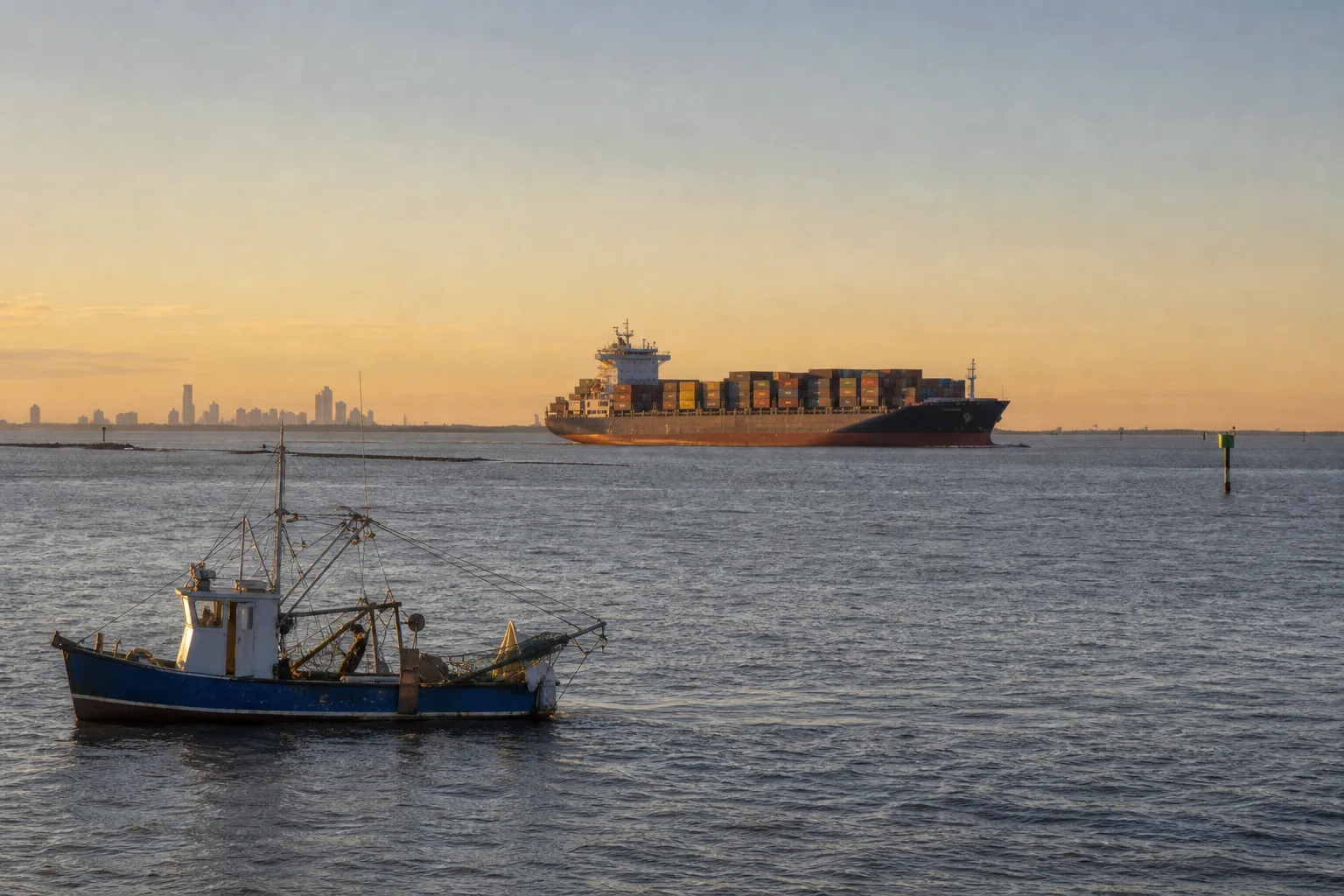
Galveston Bay is the largest estuary in Texas, about 600 square miles of mostly shallow water just southeast of Houston, and you can launch from public ramps in Galveston, Kemah, Seabrook, Texas City, La Porte and Baytown. Boaters share it with large ships in the Houston Ship Channel, so the keys are knowing where the channel is, staying out of its way, reading the tide and wind, and carrying a Texas fishing license with a saltwater endorsement if you fish.
This guide covers where to launch, which marinas to call, how the bay's shallow depths and the ship channel affect your route, tides, and the fishing license rules. Where we could not confirm a detail from an official source, we tell you who to check with.
The bay in numbers
The Galveston Bay Estuary Program (GBEP), a Texas state program, describes the bay as covering about 384,000 acres, or 600 square miles, with an average depth of only about 7 feet. It is the largest of the 12 estuaries along the Texas coast and is made up of four major sub-bays: Galveston, Trinity, East and West bays, with 232 miles of shoreline. The practical meaning for a boater is simple: most of the bay is shallow, and the deep water is where the dredged channels are.
Use a current NOAA chart or a chartplotter with up-to-date charts, and learn the difference between your boat's draft and the posted depth; our draft, beam and freeboard guide explains how to measure it. We do not quote depths for individual spots because they change with dredging, storms and silting.
Where to launch
Marinalo lists public ramps from the TPWD public boat ramp inventory. Here is what the city pages show (Marinalo data, October 2026):
| City | Ramps listed | Examples |
|---|---|---|
| Galveston | 7 | Galveston Island State Park (three launches), Lee and Joe Jamail Bay Park, West Bay, West End Marina |
| Texas City | 6 | Texas City Dike ramps, Dollar Point, Dickinson Bayou |
| Baytown | 4 | Bayland Park (Tabbs Bay), Children's Nature Discovery Area (Burnett Bay), Roseland Park (Cedar Bayou), San Jacinto River |
| Seabrook | 2 | Pine Gully Park (Galveston Bay), Kemah Channel |
| Kemah | 1 | Galveston Bay Boat Ramp |
| La Porte | 1 | Sylvan Beach Park |
Marinalo's pages do not show lanes, fees or parking for these ramps, so call the city or park before you tow in on a summer weekend. The state-wide list is on the Texas boat ramps page. If you are new to backing a trailer down a crowded ramp, read how to back up a boat trailer first.
Marinas and slips
Marinalo lists 8 marinas in Galveston, among them Galveston Yacht Marina, Pier 77, Payco Marina, Pelican Rest Marina, Waterman's Marina and West End Marina, all with "rates on request." In Kemah the data shows 6 marinas, and one with a published rate sheet: Portofino Harbour Marina at $60 per night for a 40-ft boat. Always confirm by phone. For wider price context see Texas boat slip prices in 2026 and 40-ft slip prices in Texas, and for fuel check the Texas fuel docks list.
The bay is on the hurricane coast. If you keep a boat here, read hurricane prep for boat owners before you sign a marina contract.
The Houston Ship Channel and other big-ship traffic
The Houston Ship Channel runs through the bay and carries tankers, bulk carriers and other deep-draft vessels. Those ships cannot stop quickly, turn sharply or leave the dredged channel, and from a boat's deck they can look slower and farther away than they are. Three rules help:
- Do not impede. Under the federal navigation rules, a vessel under 20 meters (about 65 feet) must not impede the passage of a vessel that can safely navigate only within a narrow channel (33 CFR 83.09, Rule 9).
- Cross at a right angle and without delay, well ahead of or behind any ship, never in front of one that is close. Never anchor or fish in the channel itself.
- Follow Vessel Traffic Service instructions. The Coast Guard runs a vessel traffic service for the Houston-Galveston area. Check the current Coast Guard Sector Houston-Galveston guidance for the radio channels and any rules that apply to recreational boats, and keep a VHF radio on board; see VHF marine radio basics.
The Coast Guard also issues local notices about shoaling and security zones around terminals and industrial sites, so check Captain of the Port notices and the chart before running near docks and refineries. We do not list zone distances here because they change.
The Intracoastal Waterway crossing
The Gulf Intracoastal Waterway, a protected barge route along the Gulf coast, crosses Galveston Bay and shares water with the bay's other traffic, including tows pushing barges. Barges are long and slow to turn, and the tow's wake and prop wash can be strong. Pass with care, slow down near the channel edges, and read our guide to the Intracoastal Waterway in Florida and Texas for how the route works and how to behave around tows.
Tides, wind and water levels
Marinalo's Galveston tide chart is built from NOAA harmonic constants and shows predicted highs and lows, a seven-day outlook and the daily range. Tides on the upper Texas coast are small, and wind has a large effect: a strong north wind can push water out of the bay, and a strong south wind can push it in, so actual water levels can differ from the chart. In a bay averaging about 7 feet deep, that matters. Read the chart with how to read a tide chart, and check the NWS forecast with the Beaufort scale in mind, because the shallow bay can build a steep chop quickly. For alerts, see special marine warning vs small craft advisory.
Fishing in Galveston Bay
TPWD says anglers 17 and older generally need a Texas fishing license plus a saltwater endorsement to fish in public salt water. People under 17 are exempt, and fishing inside a Texas state park is license-free, but a park run by a city or county is not. Size and bag limits vary by species and can change, so check the current TPWD Outdoor Annual before you keep fish. If you want the best times to be on the water, see best time to fish. Planning an offshore trip from the Gulf side? Texas state waters end 9 nautical miles from shore; our red snapper season article covers the federal-waters rules, and the Port Aransas boating guide covers the lower coast.
Protecting the bay
GBEP works on habitat, water quality and public use across the bay and its watershed, which it puts at about 24,000 square miles (roughly 9 percent of the state). Simple habits help: keep trash and fishing line aboard, pump out rather than discharge, and stay off shallow oyster and marsh edges. Fuel carefully; our ethanol-free gas guide explains what to ask for at the dock.
FAQ
How deep is Galveston Bay?
Very shallow overall. The Galveston Bay Estuary Program gives an average depth of about 7 feet, with deeper dredged channels such as the Houston Ship Channel. Use a current NOAA chart for specific areas.
Where can I launch a boat on Galveston Bay?
Marinalo data lists public ramps in Galveston (7), Texas City (6), Baytown (4), Seabrook (2), Kemah (1) and La Porte (1). Confirm fees and hours locally.
Can I cross the Houston Ship Channel in a small boat?
Yes, but do not impede large vessels, cross at a right angle and well clear of ship traffic, and follow any Vessel Traffic Service instructions.
Do I need a license to fish in Galveston Bay?
If you are 17 or older, TPWD requires a Texas fishing license with a saltwater endorsement for public salt water, with some exemptions such as fishing inside a Texas state park.
Does Galveston Bay have big tides?
No. Tides on the upper Texas coast are small, and wind often changes water levels more than the tide does.
Sources
- Marinalo data, October 2026: Galveston marinas, Kemah marinas, Galveston tides, and the Texas city ramp pages linked above (source: TPWD Public Boat Ramps)
- Galveston Bay Estuary Program, Galveston Bay 101
- 33 CFR 83.09, Narrow channels (Rule 9)
- TPWD, Purchase Requirements for Licenses, Endorsements and Tags
- TPWD, Red Snapper (state waters out to 9 nautical miles)