
The Intracoastal Waterway in Florida and Texas: A Boater's Guide
What the Intracoastal Waterway (ICW) is, how the Atlantic ICW and Gulf ICW differ, depths, mile markers, drawbridge signals, barge traffic and manatee zones.
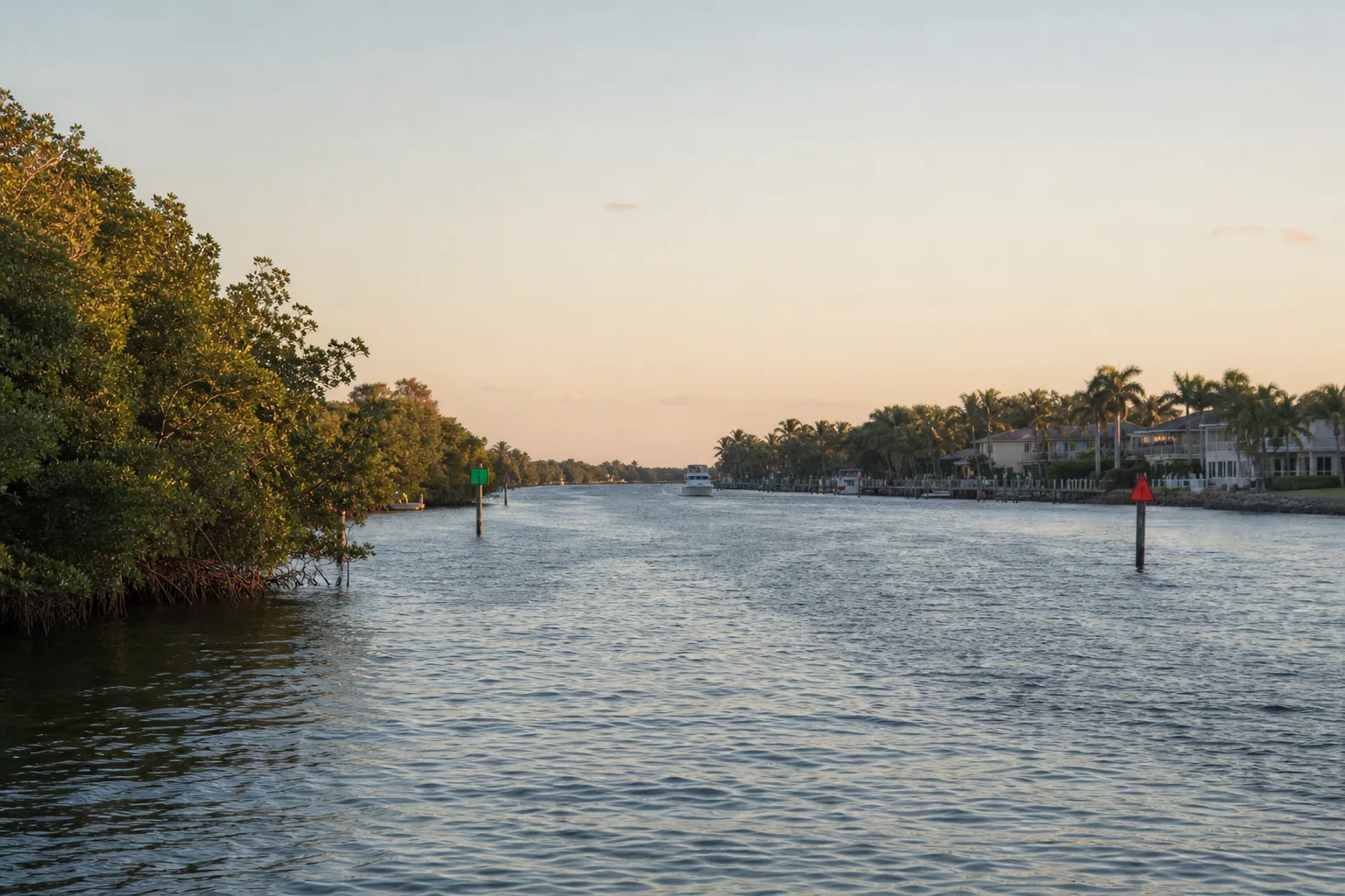
The Intracoastal Waterway (ICW) is a federally maintained channel system along the Atlantic and Gulf coasts that lets boats travel behind barrier islands instead of in open ocean. The Atlantic ICW runs from Norfolk, Virginia, down to Key West, Florida, and the Gulf Intracoastal Waterway (GIWW) crosses Texas for about 423 miles from the Sabine River to Port Isabel, according to the U.S. Army Corps of Engineers (USACE).
This guide explains how the two systems differ, what the published depths mean, how mile markers work, what to do at drawbridges, how to share the GIWW with barges and where manatee speed zones apply in Florida.
Atlantic ICW vs Gulf ICW at a glance
| Item | Atlantic ICW (AICW) | Gulf ICW (GIWW), Texas section |
|---|---|---|
| Route | Norfolk, VA to Key West, FL | Sabine River to Port Isabel, TX (about 423 miles, USACE) |
| Mile markers | Statute miles from Norfolk (Mile 0) to Mile 1243.8 at Key West (NOAA Coast Pilot) | Statute miles east and west of Harvey Lock near New Orleans; Texas runs roughly 266 to 681 WHL (cruising guide) |
| Federal project depth | 12 feet from Norfolk to Fort Pierce, 10 feet to Miami, 7 feet to Key West (NOAA Coast Pilot) | 125 feet wide by 12 feet deep (USACE) |
| Traffic | Mostly pleasure boats and many drawbridges in Florida | Heavy commercial tows and barges |
| Marinalo ramp data | 54 public ramps and launches tagged to the Atlantic ICW in Florida, 38 boat ramps and 16 paddle launches (FWC inventory) | 1 public ramp tagged to the Intracoastal Waterway in Texas (TPWD inventory) |
The Marinalo numbers are from the Atlantic ICW page and the Texas Intracoastal Waterway page (Marinalo data, October 2026). They count ramps tagged to that exact water body; many launches along the coast are listed under the town or bay they sit on, so also browse the Florida and Texas boat ramp hubs.
The Atlantic ICW in Florida
NOAA's Coast Pilot gives the Atlantic ICW mileage from Norfolk, Virginia (Mile 0.0) to Mile 1243.8 at Key West. Distances along the ICW are in statute miles, even though most other marine distances are in nautical miles. If you need to convert, Marinalo has a nautical miles to miles tool.
In Florida the channel passes through places such as Jacksonville, Daytona Beach, Fort Pierce, Palm Beach, Fort Lauderdale and Miami. Marinalo's Atlantic ICW page names Palm Coast, Jupiter, Daytona Beach and Ponce Inlet among its ramp locations, and it shows 36 free ramps and 1,418 trailer spaces across the 54 entries. Many ramps there are in saltwater canals. Marinalo shows a $10 fee at some ramps, so check each ramp page before you go.
Near the waterway you will also find a lot of services. For fuel, check the Florida fuel docks page, and for marinas start at the Florida marinas hub.
The Gulf ICW in Texas
Texas is the western end of the GIWW. USACE says legislation passed in 1942 extended the canal to Brownsville and set it at 125 feet wide and 12 feet deep, and that the Texas portion is about 423 miles from the Sabine River to Port Isabel. Texas sponsors the main channel under the Texas Coastal Waterway Act of 1975, and the Corps works with the Texas Department of Transportation, the Texas ports and the Gulf Intracoastal Canal Association to keep it deep and wide enough for shipping.
GIWW mile markers are measured from Harvey Lock near New Orleans, so locations are written "WHL" (west of Harvey Lock). One cruising guide lists the Texas section as running from 266.0 WHL at the Sabine River to 681.5 WHL. Use official charts for the exact mile of a bridge or launch.
Marinas and fuel along the Texas coast are covered by the Texas marinas hub and the Texas fuel docks page. Marinalo has marina pages for coast towns such as Galveston and Corpus Christi.
Depths: what "authorized depth" really means
A federal project depth is a target, not a guarantee. Channels shoal, especially near inlets, and dredging happens on a schedule that depends on funding. The Coast Pilot lists 12 feet as the Atlantic ICW project depth from Norfolk to Fort Pierce, then 10 feet to Miami and 7 feet to Key West; the Miami to Key West section has been completed only as far as Cross Bank (ICW Mile 1152.5), according to the same source. Another USACE-related technical document gives slightly different segment details, which is a good reason to treat any single number as a starting point.
- Check the latest NOAA chart and the Coast Guard Local Notice to Mariners for your section.
- Sail or motor with the tide when you can: shoals matter most at low water.
- Know your draft. The Logbook guide to draft, beam and freeboard explains the terms.
- Stay in the marked channel.
Drawbridges: signals and rules
Coast Guard drawbridge rules are in 33 CFR Part 117. The general rule in 33 CFR 117.5 is that drawbridges must open promptly and fully for vessels when a request or signal is given in accordance with the rules, except as otherwise authorized or required by that part. Many ICW bridges have posted openings or restricted hours, which are listed in 33 CFR Part 117, Subpart B and on the bridge's own sign.
Under 33 CFR 117.15, you can request an opening with a sound signal or by radiotelephone:
- Request: one prolonged blast (four to six seconds) followed by one short blast (about one second).
- Bridge says "open": the same signal, one prolonged and one short blast.
- Bridge cannot open now: five short blasts in rapid succession.
Most boaters call on VHF instead. Our VHF marine radio guide covers channels and procedure; check the bridge sign and chart for its working channel. Do not assume a fixed bridge has the clearance shown for a "typical" boat. Know your air draft with antennas, radar arch or T-top included.
Barges and tows on the GIWW
The Texas GIWW is a working canal. Cruising guides advise recreational boats to yield, keep wake small and arrange passes over VHF; one suggests calling towboats on channel 13 or 16 to ask when a pass is safe and what traffic is ahead. Barges turn wide and need a long distance to stop, and commercial crews expect pleasure craft to stay clear. A few habits help:
- Keep VHF on and listen for security calls from tows.
- Do not cross close in front of a tow. A tow cannot stop in time.
- Slow down when passing or being passed to reduce wake damage and suction.
- Have anchoring and mooring options in mind; development limits safe places to tie up, according to a state-sponsored Texas study.
- Carry current charts and lights; see the Logbook guide to boat navigation lights if you plan any night legs.
Manatee zones and no-wake areas in Florida
Florida's Fish and Wildlife Conservation Commission (FWC) posts manatee protection zones with waterway signs, and all boat and personal watercraft operators must comply with them. Zones vary: FWC's data includes idle speed, slow speed, speed-limit zones, motorboats prohibited and no-entry areas, and some are seasonal rather than year-round. One FWC release says seasonal manatee zones apply from April 1 through November 15 in certain areas, but the dates and hours vary by zone, so read the sign. FWC adds that the force of a strike at 30 miles per hour is four times that of a strike at 15 miles per hour.
See the Logbook guides to manatee season in Florida and no-wake zones for how to read the signs and what the speeds mean.
Planning a trip on the ICW
- Pick your section and chart it, noting bridges and their hours.
- Check fuel stops on the Florida and Texas fuel dock pages.
- Check tides and currents; see Marinalo tide times for tide predictions.
- Call bridges and tows on VHF.
- Have a plan for weather; the Logbook explains marine warnings and advisories.
FAQ
What is the ICW?
The Intracoastal Waterway is a network of sheltered channels, natural and dug, along the Atlantic and Gulf coasts maintained by the federal government.
How deep is the Intracoastal Waterway?
Project depths vary. NOAA's Coast Pilot gives 12 feet from Norfolk to Fort Pierce, 10 feet to Miami and 7 feet to Key West on the Atlantic ICW; USACE lists the GIWW in Texas as 125 feet wide by 12 feet deep. Actual depths can be less because of shoaling.
What is the difference between the AICW and the GIWW?
The Atlantic ICW runs from Virginia to Key West, with mile markers counted from Norfolk. The Gulf ICW runs along the Gulf coast, with mile markers counted from Harvey Lock near New Orleans, and in Texas it carries heavy commercial traffic.
How do I ask a drawbridge to open?
Use one prolonged blast followed by one short blast, or call on VHF radio, as described in 33 CFR 117.15. Check the sign for the bridge's schedule.
How long is the Texas section of the GIWW?
About 423 miles from the Sabine River to Port Isabel, according to USACE.
Do manatee zones apply on the ICW?
Yes, where signs are posted. FWC says boaters must comply with posted manatee zones, which can be year-round or seasonal.
Sources
- Marinalo, Atlantic ICW boat ramps and Texas Intracoastal Waterway boat ramps, October 2026.
- NOAA, Coast Pilot 4, Chapter 12 (ICW mileage and project depths).
- U.S. Army, What is the district's role in maintaining the GIWW? (Galveston District).
- Legal Information Institute, 33 CFR 117.5, When the drawbridge must open, and 33 CFR 117.15, Signals.
- Florida Fish and Wildlife Conservation Commission, Information for Boaters and PWC Operators.
- Waterway Guide, Cruising the Western Gulf Coast.
- Offshore Blue, Gulf Intracoastal Waterway, Texas (WHL mile range).
- Texas Department of Transportation-hosted study, Gulf Intracoastal Waterway study.