
Lake Okeechobee Boating and Fishing Guide
Lake Okeechobee boating and fishing guide: lake size, 19 public ramps, the Okeechobee Waterway and locks, lake level sources, bass fishing and hazards.
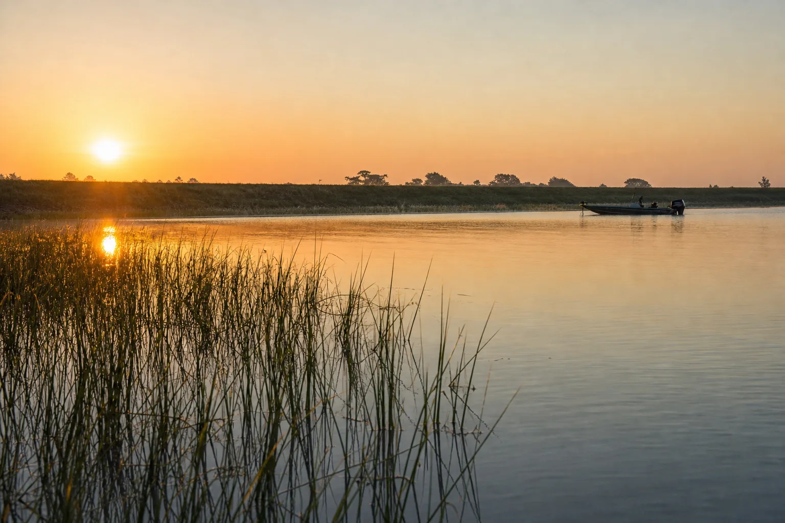
Lake Okeechobee is Florida's largest lake, about 730 square miles and shallow for its size, ringed by the Herbert Hoover Dike and with 19 public boat ramps on the Marinalo list, 17 of them free. Boaters come for bass and crappie fishing and for the Okeechobee Waterway, which crosses the lake between the Gulf and Atlantic coasts.
This guide covers the lake's size and depth, where to launch, how the waterway and its locks work, where to find the lake level, what FWC says about fishing, and the hazards that catch first-time visitors. Figures come from official agencies or Marinalo data from October 2026.
Lake Okeechobee at a glance
| Fact | Detail | Source |
|---|---|---|
| Area | About 730 square miles, roughly 37 miles long and 30 miles wide | FWC and SFWMD summaries |
| Depth | Open water averages less than 10 feet | State ecosystem report cited by SFWMD |
| Dike | Herbert Hoover Dike, about 143 miles around the lake | Reported by the Associated Press, 2023 |
| Public ramps | 19 open ramps, 17 free, 839 trailer spaces | Marinalo data, October 2026 (FWC inventory) |
| Water | Freshwater | FWC inventory |
Lake Okeechobee is often called the second largest freshwater lake entirely within the contiguous United States.
Boat ramps on Lake Okeechobee
The Lake Okeechobee boat ramps page maps all 19 ramps and launches in the FWC Florida Boat Ramp Inventory, from Moore Haven to Okeechobee, Belle Glade and Clewiston. The largest ones in Marinalo data are:
| Ramp | Lanes | Trailer spaces | Fee |
|---|---|---|---|
| City of Belle Glade, Torry Island Public Boat Ramp (Pavilion Side) | 6 | 206 | Free |
| Alvin L. Ward Park, Lake Okeechobee Boat Ramp | 3 | 168 | Free |
| Clewiston City Marina and Boat Ramp | 6 | 130 | Free |
| Cliff Betts Jr. Lakeside Recreation Area (Culvert 7) | 3 | 50 | Free |
| Okee-Tantie Recreation Area Airboat Ramp | 2 | 48 | Not listed |
| Uncle Joe's Motel and Campground | 1 | 12 | $5 |
City pages are also available for Clewiston, Okeechobee and Pahokee. Fees and hours change, so confirm with the operator. For ramps elsewhere in the state, use the Florida boat ramps directory.
The Okeechobee Waterway and locks
USACE describes the Okeechobee Waterway as a channel of about 155 miles across Florida from Fort Myers to Stuart. It runs through Lake Okeechobee and consists of the Caloosahatchee River on the west side and the St. Lucie Canal on the east side. USACE's Jacksonville District lists these locks on the waterway: W.P. Franklin, Ortona, Moore Haven (also called Julian Keen Jr. Lock and Dam), Port Mayaca and St. Lucie.
USACE navigation notices give lock hours of 7 a.m. to 5 p.m. daily, with the last lockage beginning at 4:30 p.m., and the Corps closes or limits operations during tropical storms and other events. Check the Corps' current notices to navigation before you plan a crossing. Plan transits for daylight, and read our hurricane prep for boats guide in storm season. We did not verify controlling depths or bridge clearances, and they vary with the lake level, so use current charts and the Corps' notices. From the west end, see boating in Cape Coral, since the Caloosahatchee passes through that part of Lee County.
Checking the lake level
Lake level is the most important number for boating here, because the lake is shallow. USACE Jacksonville District and the South Florida Water Management District both publish the lake stage. We link to them rather than quote a number that would be stale tomorrow. For reference, FWC's Lake Okeechobee fishing page lists a lake level of 11.62 feet NGVD as of September 21, 2026, and notes that the record low was 8.82 feet in July 2007. Check the USACE current Lake Okeechobee level or the SFWMD Lake Okeechobee page for today's reading. In a lake this shallow, a few feet of change can matter for ramps and channels, so look before you launch.
Lake Okeechobee fishing
FWC's fishing forecast describes Lake Okeechobee as a strong largemouth bass and black crappie fishery. The forecast says fall can bring good-sized pre-spawn Florida bass, with topwater baits picking up as spawning approaches, and that golden shiners are the top live bait. For crappie, FWC expects activity to improve in November and December, with January typically offering the best odds for harvestable fish. It suggests working vegetation edges early and late in the day and jigging to cover water.
FWC changes bag and length limits from time to time, and the lake's old special bass rule has been replaced by statewide rules, so read the current regulations on the FWC freshwater page before you keep a fish. You need a Florida fishing license in most cases: see our Florida fishing license guide. FWC also recommends that anyone unfamiliar with the lake think about hiring a guide.
Boats for the lake
Many anglers use bass boats, but the lake's shallow rim canals and marsh edges suit smaller craft. Our jon boat guide and the skiff, bay boat and flats boat guide compare hulls that float in little water. Center console boats work for the open lake and the waterway.
Hazards and safety
- Shallow water. With an average depth under 10 feet, waves build steeply in wind. A short, choppy lake is hard on small boats.
- Weather. Afternoon storms are common in summer, and open water gives little shelter. Learn the alerts in special marine warning vs small craft advisory and the VHF marine radio guide.
- Vegetation and stumps. We found no official hazard list, so stay in marked channels and keep your lower unit trimmed up near shore.
- Remote stretches. Carry a charged phone, a VHF radio and a way to tell people your plan.
- Life jackets. See Coast Guard approved life jackets.
The lake is freshwater, so you will not need to worry about the tides. For saltwater trips at either end of the waterway, see Florida tide pages.
Fuel and supplies
Marinalo's Florida fuel docks page lists 104 marinas where a source confirms a fuel dock. Fuel prices change daily, so call ahead. Some lakeside towns have few services, so top off before you launch. If you run a boat on ethanol blends, read our guide to ethanol-free gas for boats.
Planning a day on the lake
Start with the ramp, because the lake is large and the shore is long. Marinalo's list spreads across the south shore (Clewiston, Belle Glade, Pahokee, South Bay), the west side (Moore Haven and the Harney Pond and Lakeport areas) and the north shore (Okeechobee and the Okee-Tantie Recreation Area). Pick the ramp closest to the water you plan to fish or cross, since a long run on a shallow lake in a chop is slow and hard on the boat.
Before you leave, check the lake level, the National Weather Service marine forecast, your fuel and your life jackets. Tell someone your launch point and return time. If you plan to cross the lake to reach a lock, work out the distance in nautical miles with the nautical miles to miles converter and the speed with the knots to mph converter. If you are weighing a bigger boat for the waterway, the Marinalo boat cost calculator helps you see the real cost of owning one.
FAQ
How big is Lake Okeechobee?
About 730 square miles, roughly 37 miles long and 30 miles wide, with an average depth under 10 feet.
How many boat ramps are on Lake Okeechobee?
Marinalo data from October 2026 lists 19 open ramps and launches, 17 of them free, with 839 trailer spaces.
Where can I find the Lake Okeechobee water level?
USACE Jacksonville District and the South Florida Water Management District both publish it. Check them before you launch.
Can you boat across Florida through Lake Okeechobee?
Yes, on the Okeechobee Waterway from Fort Myers to Stuart, which USACE describes as about 155 miles, passing through locks. Check lock hours.
What fish are in Lake Okeechobee?
FWC highlights largemouth bass and black crappie. Check FWC rules for current limits.
Sources
- FWC: Lake Okeechobee fishing forecast
- USACE Jacksonville District: Okeechobee Waterway
- South Florida Water Management District: Lake Okeechobee
- USACE Notice to Navigation 2025-022: Okeechobee Waterway
- Associated Press via Insurance Journal: Herbert Hoover Dike completion, January 2023
- Marinalo data, October 2026: Lake Okeechobee boat ramps (FWC Florida Boat Ramp Inventory)