
Boating in Cape Coral: Canals, Bridges and Ramps
Boating in Cape Coral, Florida: how the canal system works, saltwater vs freshwater canals, public ramps and fees, marinas, tides and Caloosahatchee access.
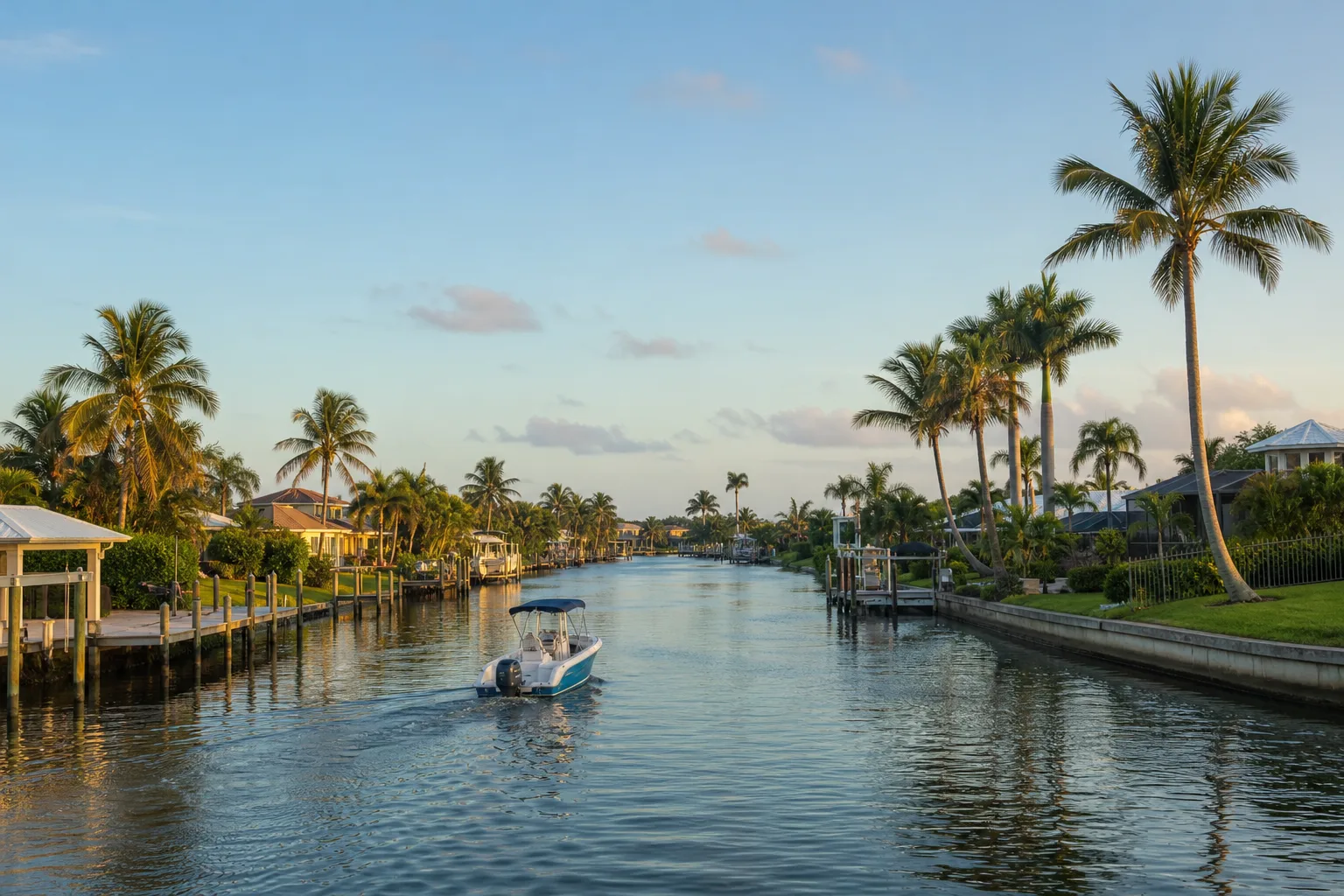
Boating in Cape Coral, Florida, centers on a canal system of more than 400 miles, according to the City of Cape Coral, with many canals running to the Caloosahatchee River and on to the Gulf. Some canals are saltwater and open to the river, while others are freshwater and sealed off, so which ramp you use decides where your boat can go.
This guide explains the canal types, the public ramps and their fees as listed in Marinalo data from October 2026, the marinas, the tide page to use, manatee speed zones and what the Caloosahatchee connection means for longer trips. Where we could not confirm a figure from an official source, we leave it out and say who to call.
How the canal system works
The City of Cape Coral states that the city has more than 400 miles of canals, many with direct access to the Caloosahatchee River and the Gulf. Its Parks and Recreation Department's Marine Services Division oversees the waterways. News coverage of a city interview gives a split of roughly 222 miles of saltwater canals and 156 miles of freshwater canals, but because we could not confirm that on a city page, we only rely on the "more than 400 miles" figure.
What matters for a boater is the label on each ramp. In the FWC Florida Boat Ramp Inventory, as shown on Marinalo, Cape Coral ramps are either a saltwater canal, a freshwater canal or the river itself:
- Saltwater canals connect toward the river and the Gulf. Burnt Store Public Boat Ramp is labeled a saltwater canal.
- Freshwater canals hold fresh water. The BMX Strausser Park ramp and most of the city's primitive ramps are freshwater canal ramps.
- The Caloosahatchee River is where Horton Park and Rosen Park ramps sit, with brackish water.
Do not assume you can move a boat between a freshwater canal and a saltwater canal. We did not find an official map statement on which canals connect, so check the city's Marine Services Division before you plan a route.
Public boat ramps in Cape Coral
The Cape Coral boat ramps page lists 18 ramps, 2 paddle launches, 14 free sites and 319 trailer spaces in October 2026. The city says all Cape Coral boat ramps are accessible 24/7 unless closed for safety or repairs, and that it sells daily and annual trailer parking permits. Check the city's boat ramp parking page for permit prices.
| Ramp | Water | Lanes | Trailer spaces | Fee |
|---|---|---|---|---|
| Rosen Park Public Boat Ramp | Caloosahatchee River | 4 | 55 | $15 |
| Horton Park Public Boat Ramp | Caloosahatchee River | 2 | 31 | $15 |
| Burnt Store Public Boat Ramp | Saltwater canal | 2 | 19 | $10 |
| BMX Strausser Park Public Boat Ramp | Freshwater canal | 2 | 15 | $10 |
| Matlacha Park Boat Ramp | Matlacha Pass | 2 | 28 | $10 |
| D & D Matlacha Bait, Tackle and Ramp | Matlacha Pass | 1 | 36 | $15 |
The remaining city sites are primitive ramps on freshwater canals. Each has one lane, a handful to two dozen trailer spaces, and is free in the inventory. They suit jon boats and small skiffs, which our guides to jon boats and skiffs, bay boats and flats boats explain. For paddlers, the inventory lists a free kayak launch at Sirenia Vista Park on a saltwater canal and a free paddle launch at Matlacha Park. See all Florida kayak launches.
Fees and hours change. Call the city or look at the posted signs before you tow. For a wider search, use the Florida boat ramps directory or the Fort Myers boat ramps across the river.
Marinas in Cape Coral
Marinalo data from October 2026 lists three marinas on the Cape Coral marinas page:
- Cape Coral Yacht Club, 239-574-0809
- Paradise Marina, 239-810-4787
- Tarpon Point Marina, 239-549-4900
All three list rates on request, and none is confirmed as a fuel dock in our data. For fuel, check the Florida fuel docks directory. Many Cape Coral boaters keep boats at private canal docks or on lifts instead of in marinas. Our guide to boat storage options compares those choices. If you also look at Fort Myers, see marinas in Fort Myers.
Tides in the canals
Saltwater canals rise and fall with the tide that comes up the river and out of the Gulf. Marinalo has a Cape Coral tide chart, plus nearby pages for Fort Myers and Matlacha. They use NOAA harmonic constants and are not for navigation, so check NOAA predictions when depth matters. Tide timing matters most when you pass under low bridges, run a shallow-draft route, or cross shoals at the river mouth. To learn how to read a chart, see how to read a tide chart and ebb, flood and slack tide.
Bridges and clearances
Several roads cross the Caloosahatchee near Cape Coral. We did not find official clearance figures for the Cape Coral canal bridges, so we do not list any. Before you take a tall boat or a sailboat out, check your air draft against the NOAA chart for the area and the U.S. Coast Pilot, and ask the city about specific canal bridges.
Manatee speed zones
Lee County's manatee speed zones come from state rules adopted by the Florida Fish and Wildlife Conservation Commission, in Florida Administrative Code Chapter 68C-22. FWC lists Lee County's state zones under rule 68C-22.005, and some zones are seasonal. FWC maps and signs control, because zones change and old maps are out of date. The Cape Coral canal system serves as a refuge for manatees coming from the Caloosahatchee River and Matlacha Pass, as the city's Canalwatch newsletter notes, so watch for them even on a canal. See our guide to manatee season in Florida for how to boat safely around them.
Caloosahatchee access
The Caloosahatchee River forms the west side of the Okeechobee Waterway, which the U.S. Army Corps of Engineers describes as a channel about 155 miles long across the state from Fort Myers to Stuart. Boats from Cape Coral can follow the river upstream toward Lake Okeechobee through the Corps' locks, including W.P. Franklin Lock and Ortona Lock. Our Lake Okeechobee boating guide covers the lake end of that trip. Lock hours and closures change, so check the Corps' navigation notices before you go.
Rules you should know
The City of Cape Coral notes that Florida requires a boating safety course for people born on or after January 1, 1988, and calls violations a second-degree misdemeanor. See our Florida boating license and registration page. Tropical weather matters in Southwest Florida, so read hurricane prep for boats.
FAQ
How many miles of canals does Cape Coral have?
The City of Cape Coral says it has more than 400 miles of canals.
Are Cape Coral canals saltwater or freshwater?
Both. Some canals connect to the river and the Gulf and are saltwater, while others hold fresh water. Marinalo labels each ramp's water type from the FWC inventory.
Where can I launch a boat in Cape Coral?
The city runs improved ramps at Rosen Park, Horton Park, Burnt Store and BMX Strausser Park, plus many free primitive canal ramps. Marinalo lists 18 ramps in total.
Do I have to pay at Cape Coral boat ramps?
Some do. Marinalo data shows $10 to $15 at the main city ramps and free access at primitive ramps. Check the city for trailer parking permits.
Can I boat from Cape Coral to Lake Okeechobee?
Yes, via the Caloosahatchee River and the Okeechobee Waterway, through locks run by the U.S. Army Corps of Engineers. Check lock hours and current notices.
Sources
- City of Cape Coral Parks and Recreation: boating, canals and boat ramps
- Lee County Natural Resources: Manatee protection, vessel speed restrictions
- City of Cape Coral Canalwatch newsletter (manatees in the canals)
- USACE Jacksonville District: Okeechobee Waterway
- Marinalo data, October 2026: Cape Coral boat ramps (FWC Florida Boat Ramp Inventory)
- Marinalo data, October 2026: Cape Coral marinas