
Biscayne Bay Boating Guide: Ramps, Marinas, Depths and Rules
Boating Biscayne Bay near Miami: public ramps and fees, marinas, shallow depths and tides, Biscayne National Park rules, manatee zones and sandbars.
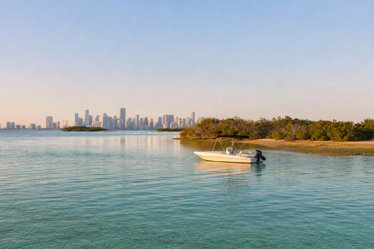
Biscayne Bay is the long, shallow lagoon between Miami and Miami Beach to the east and the mainland to the west, and it runs south into Biscayne National Park. Marinalo data (October 2026) lists 23 public ramps and launches on the bay, 11 of them trailer ramps. Most of the water is shallow, so check your draft, watch the tide, stay out of seagrass, obey the speed and manatee zones, and use NOAA chart 11451 for the national park waters.
This guide covers where to launch, the main marinas, depths and tides, what the National Park Service says about boating in the park, manatee protection zones and the nearby sandbar. Where we could not confirm a rule from an official source, we say so and tell you who to check with.
Public ramps on Biscayne Bay
Marinalo counts 23 open public ramps and launches on Biscayne Bay from the FWC Florida Boat Ramp Inventory: 11 ramps, 12 paddle launches, 7 free sites and 853 trailer spaces in total. The biggest ramps (Marinalo data, October 2026):
| Ramp | Lanes | Trailer spaces | Fee |
|---|---|---|---|
| Crandon Park Boat Ramp (Key Biscayne) | 15 | 135 | $17 |
| Bill Bird Marina, Haulover Marine Center | 11 | 160 | $17 |
| Matheson Hammock County Park | 11 | 120 | $17 |
| Black Point Park | 10 | 128 | $17 |
| Herbert Hoover Homestead Bayfront Park | 10 | 56 | $17 |
| Pelican Harbor Park | 8 | 120 | $17 |
| Regatta Park, Seminole ramp | 6 | 40 | $10 |
| Watson Island Lot 70 | 6 | 48 | $10 |
| Morningside Park | 4 | 24 | Free |
Two sites are restricted: Maurice Gibbs Park is for Miami Beach residents only, and the Hobie Beach catamaran launch on Rickenbacker Causeway prohibits motorized craft. Fees change, so confirm before you tow in. See also the city lists for Miami boat ramps and the state-wide Florida boat ramps directory. Paddlers can use launches such as Biscayne National Park's Convoy Point paddlecraft launch, Deering Point Park and Oleta River State Park; see the Florida kayak launches page.
Marinas around the bay
Marinalo data (October 2026) for the main marina cities:
| City | Marinas listed | Published rates |
|---|---|---|
| Miami | 12, with 3 fuel docks | Median $151 per night for a 40-ft boat; for example Coral Reef Yacht Club $200 per night, Pelican Harbor Marina $102 per night, Dinner Key Marina $1,100 per month |
| Key Biscayne | 1 (Key Biscayne Yacht Club, fuel dock) | $184 per night for 40 ft |
| Miami Beach | 2 (Miami Beach Marina with fuel dock, Sunset Harbour Yacht Club) | Rates on request |
| Coconut Grove | 1 (Grove Harbour Marina) | Rates on request |
Prices come from official rate sheets only, so call to confirm. For fuel, see the Florida fuel docks directory, and for longer-term costs read Florida boat slip prices in 2026. Planning to shop for a boat? Our Miami boat show 2027 article covers the event.
Depths and tides
The National Park Service says most of the waters in Biscayne National Park are very shallow, that knowing the tides is very important and that groundings cause extensive damage to boats and fragile park resources. The same applies in the northern bay. Learn your boat's draft (see draft, beam and freeboard), keep to marked channels when you can, and treat any flat as a hazard until you have seen the bottom.
Marinalo's Miami tide chart uses NOAA harmonic constants and shows highs, lows, the daily range and whether it is a neap or spring period. On October 17, 2026 the page showed a range of 1.6 ft. Timing can differ from place to place around the bay, so our guides on reading a tide chart and ebb, flood and slack explain how to plan. For the highest tides of the year, see king tides on Marinalo; they affect launch ramps and low causeways. The Miami Beach tide page is here.
Biscayne National Park: what to know
Biscayne National Park covers much of the southern bay and the reef beyond. The NPS boating page says:
- Use NOAA nautical charts; chart 11451 covers park waters.
- Personal watercraft, including jet skis and waverunners, are prohibited.
- Do not anchor on coral reefs; use mooring buoys when available.
- Comply with slow-speed zones. The park map marks idle speed and no wake areas and slow-speed areas, and it warns that zones are subject to change and the map is not for navigation, so check the current map before you go.
- Keep a sharp lookout for protected species, watch your speed at night, and keep your distance.
We were not able to confirm current park rules for Stiltsville, the cluster of historic stilt houses in the bay, so check with the National Park Service at Biscayne National Park before you plan to tie up or land there. Biscayne Bay is also a state aquatic preserve; we did not verify the preserve's boating rules, so ask the Florida Department of Environmental Protection if you need specifics.
Manatee zones and seagrass
Seagrass beds cover much of the shallow bay, and manatees graze on them. FWC explains two main speed zone types: "Idle Speed - No Wake," the minimum speed that maintains steerageway, and "Slow Speed - Minimum Wake," fully off plane and settled in the water. Some zones apply all year, others seasonally (FWC cites April 1 to November 15 for seasonal manatee zones), and the rules depend on the location, so follow the posted signs and check FWC's current zone maps. See our manatee season in Florida and no-wake zones articles.
FWC's seagrass advice: stay within marked channels whenever possible, avoid shortcuts through seagrass beds, know your boat's operating depth, and pole, paddle or use an electric trolling motor in shallow grass. Propeller scars can take months or years to recover. If you ground, stop and pole into deeper water. Florida law (s. 327.46) lets FWC and local governments set boating-restricted areas, including to protect seagrass on privately owned submerged lands, and zones are enforceable where they are clearly marked.
Sandbars and anchoring
The best-known sandbar near the bay is at Haulover; read our Haulover sandbar guide for access and the tide. For the basics of anchoring, tides and etiquette on any bar, see sandbar boating. Under Florida s. 327.44 you may not anchor or moor in a way that unreasonably creates a navigational hazard or interferes with another vessel, so stay out of channels.
Safety and legal basics
- Alcohol. Florida s. 327.35 sets the BUI limit at 0.08 blood or breath alcohol, or impairment of normal faculties; a first offense carries a fine of $500 to $1,000 and up to six months in jail, among other penalties.
- Weather. Check the NWS forecast; see special marine warning vs small craft advisory. Hurricane season matters if you keep a boat here: hurricane prep for boat owners.
- Licensing and registration. See the Marinalo Florida boating license and registration page.
- Fishing. Saltwater anglers should read Florida fishing license first.
- Rules near ramps. Idle-speed zones can be set within 500 feet of ramps and fuel pumps on waterways wider than 300 feet, and within 300 feet on narrower waterways (s. 327.46).
FAQ
How many public boat ramps are on Biscayne Bay?
Marinalo data (October 2026) lists 23 public ramps and launches on the bay: 11 trailer ramps and 12 paddle launches. Seven are free.
How deep is Biscayne Bay?
The National Park Service says most of Biscayne National Park's waters are very shallow. Use NOAA chart 11451 for park waters and a current chart or chartplotter elsewhere, since depths change.
Can I use a jet ski in Biscayne National Park?
No. The NPS says personal watercraft, including jet skis and waverunners, are prohibited in the park.
Where can I anchor in Biscayne Bay?
Not on coral reefs, and not where you create a hazard in a channel. In the park, use mooring buoys when available. Check the park's current rules for specific areas.
Are there manatee zones in Biscayne Bay?
Yes, speed zones protect manatees in many Florida waters, including slow-speed and idle-speed areas. Zones vary by place and season, so follow the posted signs and FWC's maps.
Sources
- Marinalo data, October 2026: Biscayne Bay ramps, Miami marinas, Key Biscayne marinas, Miami tides
- National Park Service, Boating in Biscayne National Park
- National Park Service, Biscayne National Park boating (PWC, anchoring, charts)
- FWC, Manatee information for boaters
- FWC, Seagrass FAQ
- Florida Statutes s. 327.46, Boating-restricted areas
- Florida Statutes s. 327.44, Interference with navigation
- Florida Statutes s. 327.35, Boating under the influence