
Deep Sea Fishing in Destin, Florida: Seasons, Distances and Fuel
Deep sea fishing in Destin, Florida: where state waters end, how reef fish seasons work, charter vs your own boat, fuel planning, tides and weather, with Marinalo data.
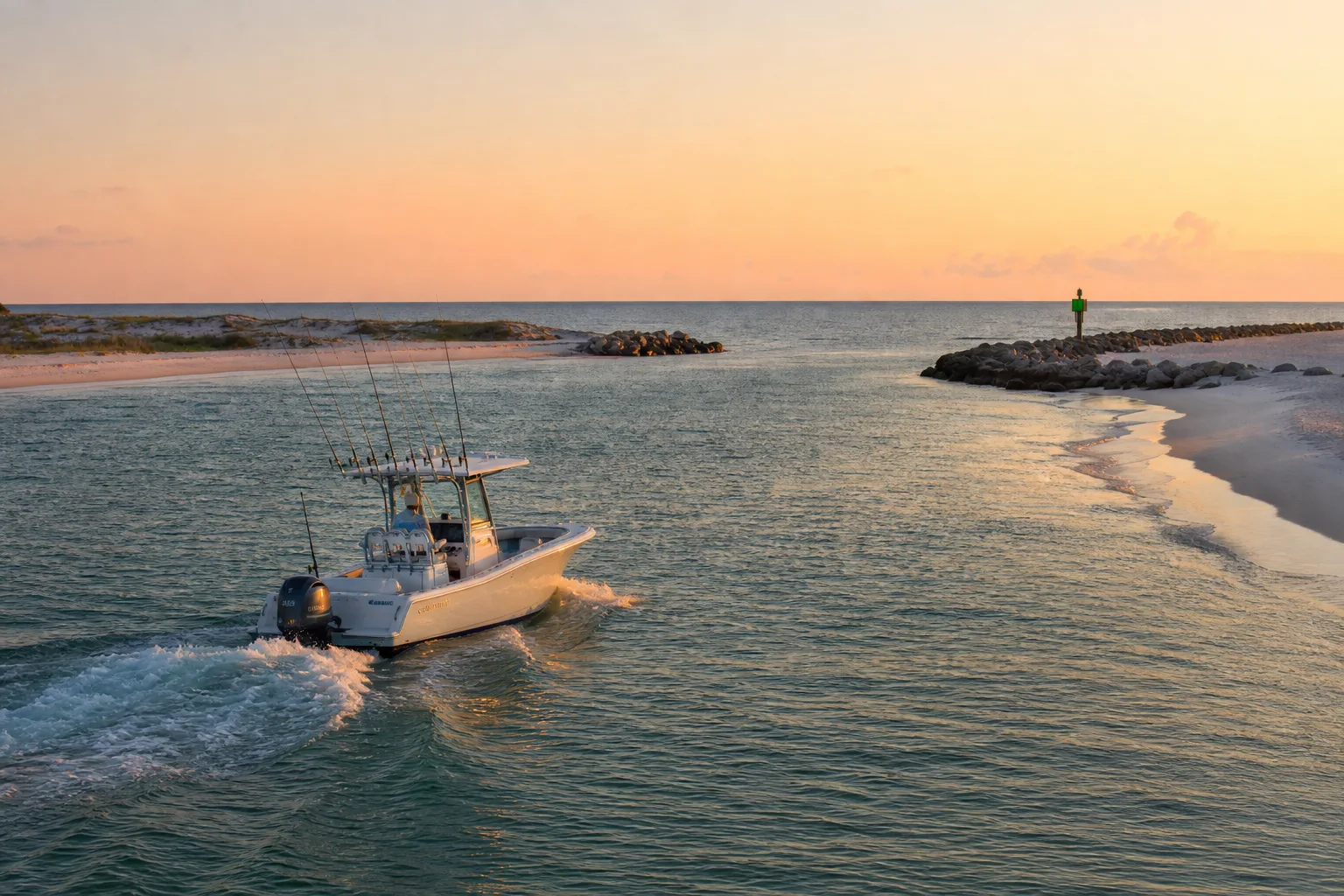
Deep sea fishing in Destin, Florida means running out of East Pass into the Gulf of Mexico, either on a charter or on your own boat. Florida's Gulf state waters end 9 nautical miles from shore, and the rules for reef fish such as red snapper and grouper can change at that line, so check the current FWC season before you plan a trip. Plan fuel, tides and weather before you leave the dock, because the Gulf can change quickly.
Why Destin works for offshore fishing
Destin sits on the Florida Panhandle, where East Pass connects Choctawhatchee Bay to the Gulf. Boats based in the bay reach open water without a long coastal run, which is why so many private boats and charter boats leave from here. Offshore fishing here usually means bottom fishing for reef fish and trolling or drifting for pelagic species. Which species you can keep depends on the season, the size and bag limits, and where you are standing when you catch the fish.
This guide does not rank fishing spots or promise catches. It covers what you can verify: the waters boundary, how to check seasons, how to choose between a charter and your own boat, where to launch, and how to plan fuel and weather.
State waters versus federal waters
FWC says Florida state waters run from shore out to 3 nautical miles on the Atlantic coast and out to 9 nautical miles on the Gulf coast. Federal waters begin beyond that line. State waters are managed by FWC. Federal waters off the Gulf coast of Florida are managed through the Gulf of Mexico Fishery Management Council and NOAA Fisheries.
The two sets of rules are often consistent, but not always. For example, FWC notes that federally permitted for-hire vessels may fish for red snapper in state waters only when both the state and federal red snapper seasons are open at the same time. Charter captains deal with this every season, which is one reason to ask your captain which rules apply on the day you go.
A quick conversion helps when you read distances: 9 nautical miles is about 10.4 statute miles. The Marinalo nautical miles to miles converter does the math for any distance.
| Zone | Where it is | Who sets the main rules |
|---|---|---|
| Florida Gulf state waters | Shore to 9 nautical miles | FWC |
| Federal waters | Beyond 9 nautical miles | Gulf Council and NOAA Fisheries |
Seasons: red snapper, grouper and other reef fish
Reef fish seasons are the part of offshore fishing that changes the most from year to year. The Florida private angler red snapper season in the Gulf is set by FWC and has had a summer segment and later fall segments in recent years. The federal season for federally permitted for-hire vessels is set separately. Dates, bag limits, size limits and required gear can change, so this article does not list them.
Before any trip, check these two official pages:
- FWC's red snapper page for the current Gulf season, bag limit and any angler requirements.
- FWC's grouper page for gag, red and other grouper seasons and limits.
Also check FWC's federal waters page to see how your catch is treated on each side of the 9 nautical mile line, and whether any reef fish angler designation or special gear, such as a descending device, is required that year. Carry a copy of the current rules or the FWC mobile app so you can check sizes at sea.
Licenses
Most anglers need a Florida saltwater fishing license, with some exemptions that FWC lists. A charter boat with a valid for-hire license generally covers the passengers aboard, but that does not apply to a boat you rent or borrow. Read our Florida fishing license guide for who needs what. If you operate a boat yourself, also check the Marinalo page on Florida boating license and registration.
Charter or your own boat?
| Question | Charter | Your own boat |
|---|---|---|
| Local knowledge of bottom and weather | Captain brings it | You build it over time |
| Rules and season changes | Captain tracks them | Your responsibility |
| Fuel and maintenance | Built into the trip price | You plan, pay and carry spare |
| Safety gear | Required of the operator | Your responsibility, including radio and life jackets |
| Flexibility | Fixed trip times | Go when conditions allow |
For a first offshore trip, a charter is the simplest way to learn how the Gulf works. If you take your own boat, match it to the trip: a center console is common offshore, and our center console boat guide explains why. Offshore runs call for a VHF radio, so read VHF marine radio basics first. Prices for charters vary by boat and season, so ask each operator directly.
Launching and berthing near Destin
According to Marinalo data, October 2026, Destin has 2 public boat ramps, both on Choctawhatchee Bay and both paid: Destin Marina at $30 with 1 lane and 20 trailer spaces, and Joe's Bayou Boat Launch at $25 with 5 lanes and 55 trailer spaces. The page lists 75 trailer spaces in total, so arrive early on weekends in summer. See the full list on the Destin boat ramps page, and for more options nearby, use the Florida boat ramps directory.
Marinalo also lists marinas close by. The Fort Walton Beach page shows one marina, Brooks Bridge Marina, and the Niceville page shows one, Emerald Coast Marina. Both list rates on request, so call for transient or slip availability. If you are comparing costs, the Florida 40-ft slip price page shows what other cities charge.
Fuel planning
As of Marinalo data, October 2026, the Florida fuel docks directory has no Destin entry, and the Fort Walton Beach and Niceville pages each show 0 fuel docks. That does not mean fuel is unavailable. It means Marinalo has no verified listing, so call your marina or the dock you plan to use and ask about hours, fuel type and whether they sell ethanol-free gas. Our guide to ethanol-free gas for boats explains why that matters for marine engines.
A common rule of thumb is the rule of thirds: use one third of your fuel going out, one third coming back and keep one third in reserve. Treat it as a minimum, not a guarantee. Wind and sea state against you on the return can raise consumption well above your calm-water numbers. Your engine manufacturer's fuel flow data or your boat's fuel gauge history is a better base than any general figure.
Tides at East Pass
Destin's tidal range is small. According to Marinalo's Destin tide page (October 17, 2026), the range that day was 0.7 ft, with a high of 0.8 ft and a low of 0.1 ft, and the highest tide of the year was 1.0 ft on October 2, 2026. Marinalo notes that wind, air pressure and river flow often change the water level more than the tide does at this location.
That does not mean you can ignore current. In a pass like East Pass, tidal current and an onshore wind can make for steeper seas, especially when the wind opposes an outgoing tide. Time your return with the weather, not just the clock. Our guides to ebb, flood and slack tide and reading a tide chart explain how to plan around it.
Weather and safety offshore
- Check the NWS marine forecast and any warnings before you go, and again before you leave the dock for the return run. Learn the difference between a special marine warning and a small craft advisory.
- Use the Beaufort scale to translate a forecast wind into sea conditions.
- File a float plan with someone ashore, wear life jackets as required, and carry a VHF radio.
- Summer thunderstorms can build fast in the afternoon. Consider leaving early and being back early.
- From June through November, follow National Hurricane Center updates, and see our hurricane prep guide.
FAQ
How far offshore do you go for deep sea fishing in Destin?
It depends on the species and the day. What you can verify is the boundary: Florida's Gulf state waters end at 9 nautical miles, and federal waters start beyond that. Ask your captain where the day's target fish are holding.
When is red snapper season in Destin?
The season is set each year by FWC for private anglers and separately by federal rules for for-hire vessels. Check FWC's red snapper page for the current dates before you go.
Do I need a fishing license on a charter boat?
A properly licensed for-hire vessel generally covers its passengers, but rules have exceptions. Confirm with the captain and read FWC's license page.
Can I launch a trailer boat near Destin?
Yes. Marinalo data, October 2026, lists 2 paid public ramps in Destin on Choctawhatchee Bay, at $30 and $25.
Where do I buy fuel in Destin?
Marinalo has no verified fuel dock listing for Destin as of October 2026, so call the marina or dock you plan to use to confirm hours and fuel type.
Sources
- Marinalo data, October 2026: Destin boat ramps, Destin tides, Florida fuel docks
- FWC, Fisheries Management in Federal Waters
- FWC, Boundary Maps and Management Zones
- FWC, Red snapper and grouper regulation pages
- Gulf of Mexico Fishery Management Council, Red snapper