
Lake Lewisville Boating Guide: Ramps, Marinas and Water Level
Lake Lewisville boating guide: 21 public ramps, the 522-ft pool, level on Oct. 17, 2026 (82.9% full), marinas in nearby cities, Corps of Engineers and Texas rules.
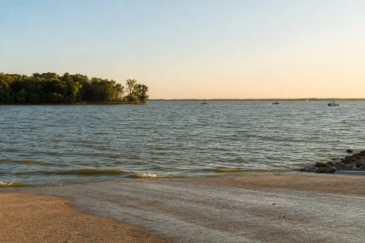
Lake Lewisville is a big North Texas reservoir on the Elm Fork of the Trinity River in Denton County, owned and operated by the U.S. Army Corps of Engineers (USACE), Fort Worth District, with 21 public ramps and launches in the Texas Parks and Wildlife Department (TPWD) inventory. On October 17, 2026 it stood at 518.3 feet, 82.9% full, about 3.7 feet under its 522-foot conservation pool (Marinalo data, October 2026, measurement date Oct. 17, 2026), so expect some ramps and shorelines to look different from a full-pool day.
This guide covers the lake's size and purpose, the ramps, marinas in the lakeside cities of Lewisville, Little Elm and Lake Dallas, what the current level means, and the rules every Texas boater follows.
Lake Lewisville at a glance
| Item | What the sources say |
|---|---|
| Location | Elm Fork of the Trinity River, Denton County near Lewisville (TPWD) |
| Owner and operator | U.S. Government, operated by USACE Fort Worth District (TWDB, TPWD) |
| Dam | Lewisville Dam; construction began November 28, 1948 and impoundment November 1, 1954 (TWDB) |
| Purposes | Water supply, mainly for Dallas and Denton and surrounding communities; flood control; recreation (TWDB) |
| Surface area | 27,175 acres at conservation pool in the TWDB data; TPWD lists 29,592 acres |
| Maximum depth | 67 feet (TPWD) |
| Conservation pool | 522 feet above sea level; emergency spillway crest at 532 feet (TWDB) |
| Typical fluctuation | 4 to 8 feet annually (TPWD) |
| Water clarity | Stained (TPWD) |
| Public ramps (TPWD inventory) | 21, via Marinalo |
Because the lake feeds the water supply of major cities and doubles as flood storage, its level rises and falls with rain and demand. TPWD's expected swing is 4 to 8 feet a year. At 3.7 feet down, today's reading sits inside that normal range. For a similar North Texas water-supply lake, compare our Lake Ray Hubbard guide.
Public boat ramps
Marinalo lists 21 public ramps and launches from the TPWD inventory. The names include Arrowhead Park, Big Sandy Park, Copperas Branch Park, Doe Branch Park, East Hill Park, Eastvale Park, Hickory Creek Park, Hidden Cove Marina, Lake Park, Little Elm Park, Oakland Park, Pilot Knoll Park, Point Vista Park, Stewart Creek Park, Sycamore Bend Park, Tower Bay Park and Westlake Park. Several parks have more than one ramp, so use the Lake Lewisville boat ramps page and its map to pick one. The inventory has no trailer-space counts, so we give none.
The Corps' lake page lists both Corps parks and leased parks, so operators and fees can differ by ramp. It links to fees, rules and park information, and the Lewisville Lake Project Office answers at (469) 645-9100 on weekdays. For other lakes, browse all Texas boat ramps.
Current level and what low water means
At 518.3 feet, the lake is 3.7 feet below conservation pool. That is not extreme, but it is enough to change how a ramp feels: a longer walk to the dock, more exposed shoreline and hazards that sit just under the surface. We found no published minimum usable elevation for the ramps on the Corps pages we could open, so we give no cutoff.
- Check the live elevation on the Corps' Lewisville Lake page, which links a USGS gauge, and the Corps' facility closure report before you go.
- Call the park or city that runs your ramp if the lake is down more than a few feet. Operators decide which ramps to close.
- Stay in marked areas, slow down near points and coves, and watch for stumps and rocks.
- The reverse also applies: after heavy rain the lake can rise and the Corps may close parks and ramps for high water.
Marinas and fuel
Marinalo has no marina page for the lake itself, so we point to marinas listed in lakeside cities and do not claim which sit on the water. The Marinalo ramp list for the lake includes a ramp at Hidden Cove Marina.
- Marinas in Lewisville: three entries, Eagle Point Marina, Pier 121 Marina and Safe Harbor Pier 121 Fuel Dock. The page shows "rates on request" and counts no fuel docks even though one entry carries that name, so call to confirm.
- Marinas in Little Elm: one marina, Cottonwood Cove Marina, the only one of these listings with an official rate on file.
- Marinas in Lake Dallas: one marina, Lake View Marina, with rates on request.
Check the Texas fuel docks map for what is on file, and fill the tank before you launch if you are unsure. For what slips cost across the state, see our Texas boat slip prices article or the 40-foot slip price page.
Planning a day on Lake Lewisville
With 21 ramps, the choice of launch point matters more than on a small lake. Pick the ramp closest to where you want to boat, confirm with its operator that it is open and what it charges, and check the lake elevation and forecast that morning. The lake is large enough that a wrong-side launch can mean a long run across open water, and a stained lake hides shallow spots. Keep the first trip to daylight, stay in marked areas, and decide before you leave where you will fuel up, since Marinalo's data does not clearly mark a fuel dock on the lake.
Fishing and plants
TPWD lists largemouth bass, spotted bass and white and hybrid striped bass among the main species and notes only small stands of pondweed. Remove any plant material from your boat and trailer before you leave the ramp; leaving harmful aquatic plants attached to a vessel or trailer is unlawful in Texas.
Rules on Lake Lewisville
The Corps sets park and ramp rules; read them on its Lewisville Lake page. TPWD rules that apply on every public lake:
- Zebra mussels: TPWD's Lewisville page carries the boater advisory "Zebra mussels have invaded this reservoir!" and says draining water is required by law and that possessing or transporting zebra mussels is illegal. Clean, drain and dry your boat, trailer, livewells and gear before traveling to another water body.
- Drain law: boaters must drain all water from the boat and gear before approaching or leaving a public fresh water body. Violations are generally a Class C misdemeanor, rising for repeat offenses. If the boat has been stored in the water on a zebra mussel lake, TPWD says to call (512) 389-4848 for decontamination guidance before moving it.
- Boater education: required for anyone born on or after September 1, 1993 to run a motor over 15 horsepower or a windblown vessel over 14 feet, with a photo ID.
- Wake, speed and night skiing: hazardous wakes are unlawful, no-wake areas mean headway speed, and skiing is not allowed from half an hour after sunset to half an hour before sunrise. See no-wake zones.
- Alcohol: operating while intoxicated (0.08 or loss of faculties) is an offense on the water.
Safety
The Corps' simple message is to wear your life jacket; see Coast Guard approved life jackets. A wide, open lake like Lewisville builds wind chop, so learn the numbers on the Beaufort scale and check the forecast. If you pull skiers or tubers, follow boat tubing safety. A radio helps in a storm; see VHF marine radio.
FAQ
Who runs Lake Lewisville?
The U.S. Army Corps of Engineers, Fort Worth District, according to TWDB and TPWD.
How deep is Lake Lewisville?
TPWD lists a maximum depth of 67 feet.
How full is Lake Lewisville right now?
On October 17, 2026 it was 82.9% full at 518.3 feet (Marinalo data, October 2026).
How many public boat ramps does the lake have?
Marinalo lists 21 from the TPWD public boat ramp inventory.
Does Lake Lewisville have zebra mussels?
TPWD's lake page says zebra mussels have invaded this reservoir, so clean, drain and dry before you leave.
How much does the level change?
TPWD lists a fluctuation of 4 to 8 feet annually.
Sources
- Texas Water Development Board: Lewisville Lake
- TPWD: Lake Lewisville
- U.S. Army Corps of Engineers, Fort Worth District: Lewisville Lake
- TPWD: Clean, drain, dry your boat
- TPWD: Mandatory boater education
- TPWD: Operation of your boat
- Marinalo: Lake Lewisville boat ramps (TPWD inventory, TWDB level), October 2026