
Lake Travis Boating Guide: Ramps, Marinas, Coves and Water Level
Lake Travis boating guide: 14 public ramps, minimum ramp levels, how deep the lake gets, Devils Cove, a map source and the level on Oct. 17, 2026.
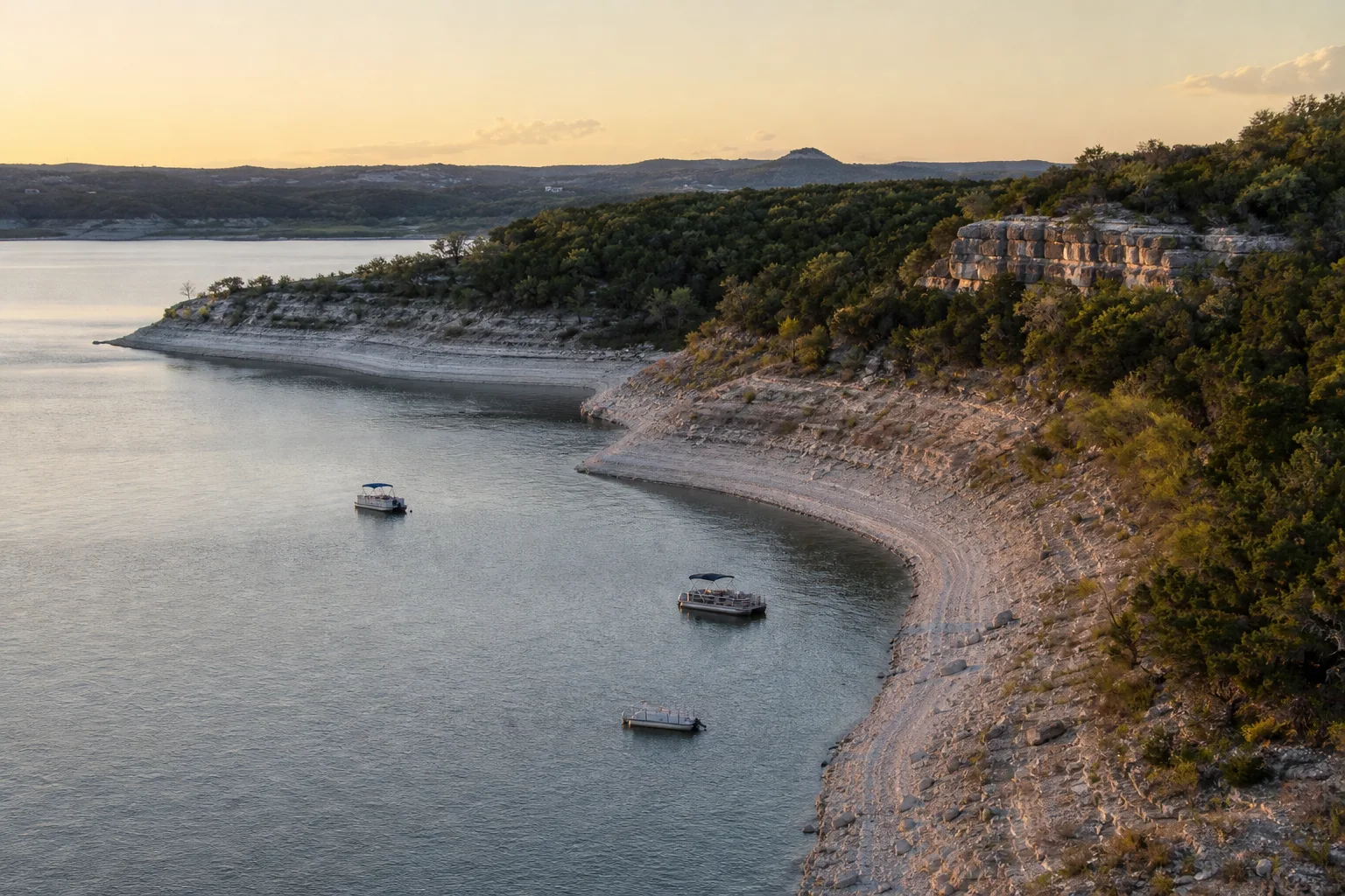
Lake Travis is a Colorado River reservoir northwest of Austin, run by the Lower Colorado River Authority (LCRA), and it has 14 public ramps and launches in the Texas Parks and Wildlife Department (TPWD) inventory. On October 17, 2026 it stood at 677.7 feet, 94.4% full, about 3 feet under its 681-foot full pool (Marinalo data, October 2026, measurement date Oct. 17, 2026). Travis rises and falls more than most Texas lakes, so the level decides which ramps you can use.
This guide covers the lake's size and depth, the ramps and the lowest water each one works at, marinas in nearby cities, the Devils Cove question, a map source, and the Texas rules that apply on every public lake.
Lake Travis at a glance
| Item | What the sources say |
|---|---|
| Location | Colorado River northwest of Austin, in Travis and Burnet counties (TPWD) |
| Owner and controlling authority | Lower Colorado River Authority (TWDB, TPWD) |
| Dam | Mansfield Dam, originally named Marshall Ford Dam; construction began March 1937 and was completed July 1939 (TWDB) |
| Surface area | 18,622 acres (TPWD); 19,297 acres at conservation pool in the TWDB 2008 survey |
| Maximum depth | 190 feet (TPWD) |
| Conservation pool | 681 feet above sea level (TPWD); 681.6 feet on the NAVD88 datum (TWDB) |
| Typical fluctuation | "High, 10-20 feet" (TPWD) |
| Public ramps (TPWD inventory) | 14, via Marinalo |
Travis is one of the Highland Lakes, and TWDB says it is operated for flood control, water supply, power generation and recreation. That mix explains the swings: it is a storage lake, not a constant-level one. Compare it with the constant-level Lake LBJ upstream and you will see why Travis boaters check the gauge first.
How deep is Lake Travis?
TPWD lists a maximum depth of 190 feet, which sits near the dam. Most of the lake is much shallower, and the usable depth over a given spot depends on the day's level. A lake that is 3 feet down, like today, exposes more shoreline, and TPWD notes the level is usually below conservation pool. Marinalo does not have a depth chart. For depth over a specific cove, use a current chart or a depth finder rather than a rule of thumb, and watch for hazards that show up when the water drops.
That also answers a common search, "lake travis depth": the one official number is 190 feet at the deepest, and the number that matters for your boat is the gauge reading on the day.
Lake Travis map and navigation
TPWD says free downloadable maps of the lake and surrounding areas are in the map section of the LCRA website, and that lighted mile marker buoys are in place to help boaters navigate. Marinalo also maps every ramp on its Lake Travis boat ramps page. Use the LCRA map for the water and the Marinalo map for the launch points.
Public boat ramps and how low they work
Marinalo lists 14 public ramps and launches on the lake from the TPWD inventory, including Arkansas Bend, Camp Creek, Cypress Creek, Dink Pearson, Jones Brothers, Mansfield Dam, Pace Bend (three ramps), Sandy Creek and Selma Hughes parks, plus three ramps named only "Lake Travis Boat Ramp". The inventory gives no trailer-space counts, so we give none.
LCRA's boat ramp page lists a minimum lake level for most of them. The list below is that page, with the margin against the 677.64-foot reading LCRA showed on October 17, 2026 (LCRA also gives an October average of 663.70 feet).
| Ramp | Minimum level (ft) | Operator (LCRA page) | Margin at 677.64 ft |
|---|---|---|---|
| Camp Creek Park | 667 | LCRA | 10.6 ft |
| Cypress Creek | 667 | Travis County | 10.6 ft |
| Gloster Bend Recreation Area | 662 | LCRA | 15.6 ft |
| Muleshoe Bend Recreation Area | 660 | LCRA | 17.6 ft |
| Narrows Recreation Area | 659.5 | LCRA | 18.1 ft |
| Pace Bend: Collier Cove | 653 | Travis County | 24.6 ft |
| Pace Bend: Tatum Cove | 653 | Travis County | 24.6 ft |
| Arkansas Bend | 647 | Travis County | 30.6 ft |
| Jones Brothers Park | 645 | City of Jonestown | 32.6 ft |
| Sandy Creek | 640 | Travis County | 37.6 ft |
| Mansfield Dam | 637 | Travis County | 40.6 ft |
| Pace Bend: Tournament Point | 631 | Travis County | LCRA lists it as closed because the ramp is underwater |
LCRA also lists Bob Wentz at Windy Point as non-motorized boats only. LCRA's page shows no fees for these ramps, but operators set fees and hours, so call the county, city or LCRA before you go. For ramps across the state, see all Texas boat ramps.
Current level and what low water means
At 677.7 feet today, every ramp in the table is far above its listed minimum. The risk comes in dry years: the October average LCRA cites, 663.70 feet, is already below the 667-foot minimums at Camp Creek and Cypress Creek and only 3.7 feet above the 660-foot minimum at Muleshoe Bend. In a typical October those two 667-foot ramps are out of range, and in a drought more ramps drop out.
- Check the gauge on LCRA's lake level page the day you go, then compare it with the table.
- Remember that a ramp can reach the water but still be steep, slick or crowded at the bottom. The minimum is a floor, not a promise.
- With the lake low, stay in the marked channel, slow down in coves and watch for exposed rock and stumps.
- When the lake is high after a flood, LCRA warns that the lakes are often closed to recreational boating.
Marinas and fuel
Marinalo has no marina page for the lake itself, so we point to marinas listed in lakeside cities rather than say which sit on Travis. Check each one's location before you count on it:
- Marinas in Austin: 18 marinas, including Commanders Point Yacht Basin and Emerald Point Marina, Lake Travis; one fuel dock across the page.
- Marinas in Lakeway: 4, including Lakeway Marina and The Rough Hollow Yacht Club & Marina.
- Marinas in Jonestown: 3, including Jones Harbor Marina and Northshore Marina At the Hollows.
- Marinas in Volente: 4, including Highland Lakes Marina and Sandy Creek Marina.
- Marinas in Spicewood: 3, including Resort Ranch Marina and Siesta Shores Marina.
- Marinas in Lago Vista: 1.
None of these pages has an official slip rate on file, so they show "rates on request". Marinalo's data shows only one fuel dock across all six cities, so fill up before you launch or call ahead. The Texas fuel docks map shows what is on file, and our Texas slip price guide explains why rates stay unlisted.
Devils Cove
Devils Cove is a cove on the lake, not a park or a ramp. It does not appear in the TPWD or LCRA ramp lists, and Marinalo has no facility there, so there is nothing official to book. If you plan to anchor in a busy cove, bring your own fenders and anchor line, set your anchor for wind shifts and keep a sober, dedicated lookout. Our no-wake zones guide covers wake courtesy near anchored boats. The cove's depth also changes with the lake level, so look at the gauge before you plan to drive in.
Rules on Lake Travis
LCRA says boaters should know the Texas Water Safety Act and the LCRA Land and Water Use Regulations, which include speed limits on the Highland Lakes. We do not repeat specific limits because they vary by area; read the current regulations on LCRA's site. TPWD rules that apply on public water:
- Boater education: required for anyone born on or after September 1, 1993 to operate a motor over 15 horsepower or a windblown vessel over 14 feet, with a photo ID.
- Clean, drain, dry: boaters must drain all water from the boat and gear before approaching or leaving a public fresh water body. TPWD's Lake Travis page carries a zebra mussel advisory and says draining is required by law.
- Operation: it is unlawful to run at an unreasonable speed, cause a hazardous wake, or run at more than headway speed in a designated no-wake area. Skiing and similar activity is not allowed from half an hour after sunset to half an hour before sunrise.
- Alcohol: operating while intoxicated (0.08 blood alcohol or loss of faculties) is an offense on the water.
Safety
Wear a life jacket that fits; see our guide to Coast Guard approved life jackets. If you tow tubes, follow boat tubing safety. The lake is big enough for wind to build waves, so check the forecast. In low water, keep off unmarked shallows. If you head upstream, our Lake Buchanan guide covers the storage lake above.
FAQ
How deep is Lake Travis?
TPWD lists a maximum depth of 190 feet. Depth at any spot changes with the lake level.
How full is Lake Travis right now?
On October 17, 2026 it was 94.4% full at 677.7 feet (Marinalo data, October 2026). LCRA's own reading that day was 677.64 feet.
How many public boat ramps does Lake Travis have?
Marinalo lists 14 from the TPWD inventory. LCRA's page lists 13 entries with operator and minimum-level details.
Where is the lake map?
TPWD says free downloadable maps are in the map section of LCRA's website, and the lake has lighted mile marker buoys.
Is there a ramp at Devils Cove?
Not in the TPWD, LCRA or Marinalo ramp data we checked. Launch at a listed ramp and boat in.
Do I have to drain my boat?
Yes. Texas requires boaters to drain all water from the boat and gear before approaching or leaving a public fresh water body.