
Lake LBJ Boating Guide: Ramps, Marinas and Water Level
Lake LBJ in the Texas Hill Country sits near full pool at about 824.6 ft on Oct. 17, 2026. See its public ramps, nearby marinas, LCRA rules and the Wirtz Dam zone.
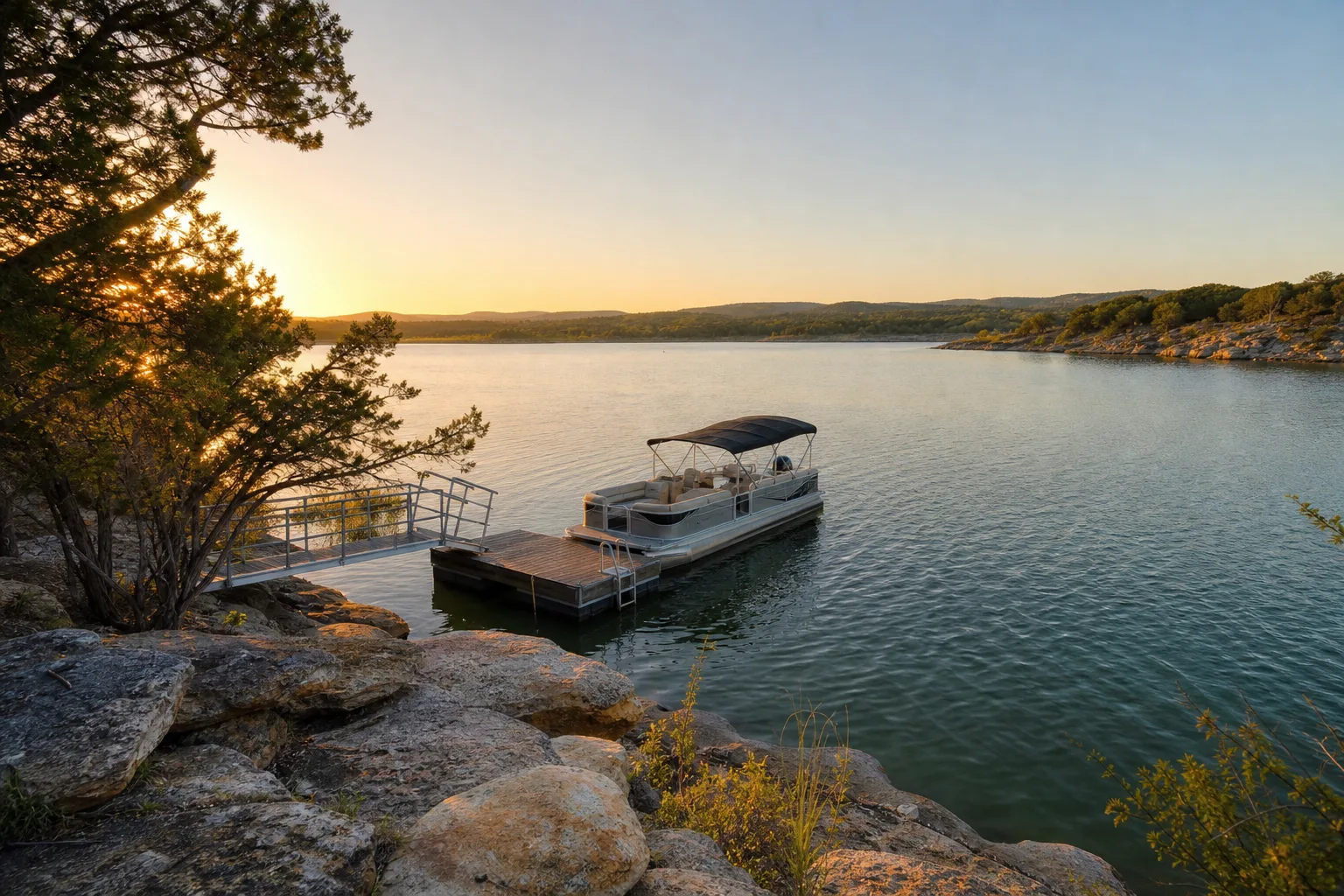
Lake LBJ (Lake Lyndon B. Johnson) is a Highland Lakes reservoir on the Colorado River in the Texas Hill Country, owned and operated by the Lower Colorado River Authority (LCRA). Unlike most Texas reservoirs, its level barely moves: on October 17, 2026 it stood at 824.6 feet, 97.8% full, against a full pool of 825 feet (Marinalo data, October 2026, from Texas Water Development Board readings).
This guide covers what kind of lake it is, the three public ramps in the Texas Parks and Wildlife Department (TPWD) inventory, the marinas Marinalo lists in nearby towns, the closed zone at Wirtz Dam and how to check the level before you go.
Lake LBJ at a glance
| Item | What the sources say |
|---|---|
| Owner and operator | Lower Colorado River Authority (TWDB reservoir page) |
| Dam | Wirtz Dam, about four miles west of Marble Falls, in Burnet and Llano counties |
| Built | Dam construction began in September 1948 and was completed in November 1951; the lake was renamed for President Johnson on April 22, 1965 (TWDB) |
| Full pool | 825 feet above sea level; LCRA's target operating range is 824.4 to 825 feet |
| Public ramps (TPWD inventory) | 3, via Marinalo |
| Water type | Freshwater |
Lake LBJ is one of the Highland Lakes, the chain of reservoirs LCRA runs on the Colorado River above Austin. LCRA describes it as a pass-through lake with no flood storage, which is why it is held in such a narrow band: water that comes in has to go out, so the level stays close to full in most conditions. It can still change during floods or when LCRA lowers it on purpose, for example for dam or dock work.
Why the level matters less here than on most Texas lakes
On many Texas reservoirs the first question is whether the ramp reaches the water. On Lake LBJ the answer is usually yes, because the lake sits within about a foot of full. The October 17 reading of 824.6 feet is inside LCRA's 824.4 to 825 foot target range. LCRA's own ramp page reported the same lake at 824.64 feet that morning and gives an October average of 824.75 feet.
Two cautions still apply. First, floods can push the lake well above normal, and LCRA notes that the lakes are often closed to recreational boating during severe floods. Second, scheduled drawdowns happen, so a short check of the official level is worth it before a long drive. For comparison with a lake whose level moves more, see our Lake Livingston guide.
Public boat ramps on Lake LBJ
Marinalo lists three public ramps on the lake from the TPWD public boat ramp inventory. All three are named "Lake LBJ Boat Ramp" in that dataset, so use the map on the Lake LBJ boat ramps page to tell them apart. The inventory has no trailer-space counts for this lake, so we do not give any.
LCRA's boat ramp information page names two lake access points that are useful to know:
- Granite Beach Recreation Area: LCRA lists a minimum usable lake level of 818 feet, far below the normal level. It is maintained by Lake LBJ Marina; LCRA gives the Lake LBJ Yacht Club Marina number for questions.
- Kingsland Community Park: no minimum lake level is listed. It is maintained by the Kingsland Lake LBJ Chamber of Commerce.
LCRA lists no fees for the Lake LBJ ramps on that page, but fees and hours can change, so call the operator before you go. For ramps across the state, browse all Texas boat ramps.
Marinas and services near the lake
Marinalo has no page for the lake itself in its marina directory, but it lists marinas in towns on or near the shore. We only name those with a Marinalo page:
- Marinas in Horseshoe Bay: three marinas, Bay Marine & Sports Center, Horseshoe Bay Resort Marina and Lake LBJ Yacht Club and Marina.
- Marinas in Kingsland: one marina, Brock Dock Outdoor Life.
None of these listings has an official slip rate on file, so they show "rates on request". Call before planning around a price. Marinalo's data also shows no fuel docks in either town, so check Marinalo's Texas fuel docks map and confirm by phone, and fill the tank before you trailer to the lake if you are unsure. If you are comparing boat types for a Hill Country lake, our deck boat vs pontoon guide is a good start.
The Wirtz Dam construction zone
Wirtz Dam is being worked on. LCRA's project page describes a $76 million replacement of all 10 floodgates, with completion expected in 2026. During the work, boat traffic is not allowed in the area about 300 feet upstream of the dam, roughly double the 150 feet that is normally off limits. A buoy line marks the zone. Stay on the lake side of it, and keep children and tow ropes well away from the dam.
What to know about the Highland Lakes chain
Lake LBJ is one of the LCRA's pass-through lakes, along with Inks Lake and Lake Marble Falls, which sit between the big storage lakes Buchanan and Travis. That means what happens upstream affects Lake LBJ, and what the dam passes affects the lakes below it. When heavy rain falls in the Hill Country, LCRA may open floodgates at Wirtz Dam, and the agency warns that releases can happen with little notice. A day that starts sunny can turn into a no-boating day if upstream water arrives, so check LCRA's flood status page the morning you go.
Rules and safety on LCRA lakes
LCRA says boaters should know both the Texas Water Safety Act and the LCRA Land and Water Use Regulations, which set speed limits on the Highland Lakes. We do not repeat specific limits here because they can change and vary by area. Read the current regulations on LCRA's site, and check TPWD for boater education, life jacket and registration rules.
- Check the level and any flood notice on LCRA's lake level pages before you leave.
- Wear a life jacket that fits; see our guide to Coast Guard approved life jackets.
- If you tow skiers or tubers, follow our boat tubing safety rules.
- Stay out of the buoyed area near the dam.
- Lakes can close during floods. Pass-through lakes like LBJ react to what the upper lakes release.
Planning a day on Lake LBJ
Start by picking a ramp on the map, then call the operator to confirm access. Note where fuel is, because Marinalo has none listed in Horseshoe Bay or Kingsland. Check the forecast and the lake's flood status, and keep the first trip simple until you know the shoreline. Dock and slip questions go to the marina by phone, as no official rates are on file.
FAQ
Who operates Lake LBJ?
The Lower Colorado River Authority owns and operates the project, according to the Texas Water Development Board.
Is Lake LBJ a constant-level lake?
Nearly. It is a pass-through lake with no flood storage, held in an LCRA target range of 824.4 to 825 feet, though floods and planned drawdowns can change that.
How full is Lake LBJ right now?
On October 17, 2026 it was 97.8% full at 824.6 feet (Marinalo data). Check LCRA for the live number.
How many public boat ramps does Lake LBJ have?
Three in the TPWD public boat ramp inventory, which Marinalo maps.
Can I boat near Wirtz Dam?
No. LCRA closes the area about 300 feet upstream of the dam during the floodgate project and marks it with buoys.
Are there fuel docks on Lake LBJ?
Marinalo has none on file in Horseshoe Bay or Kingsland. Call the marinas to ask.