
Islamorada Sandbar Guide: Location, Tides and Rules
A practical Islamorada sandbar guide: where boaters find it near Whale Harbor, how tides change it, Florida Keys sanctuary rules, plus marinas and ramps.
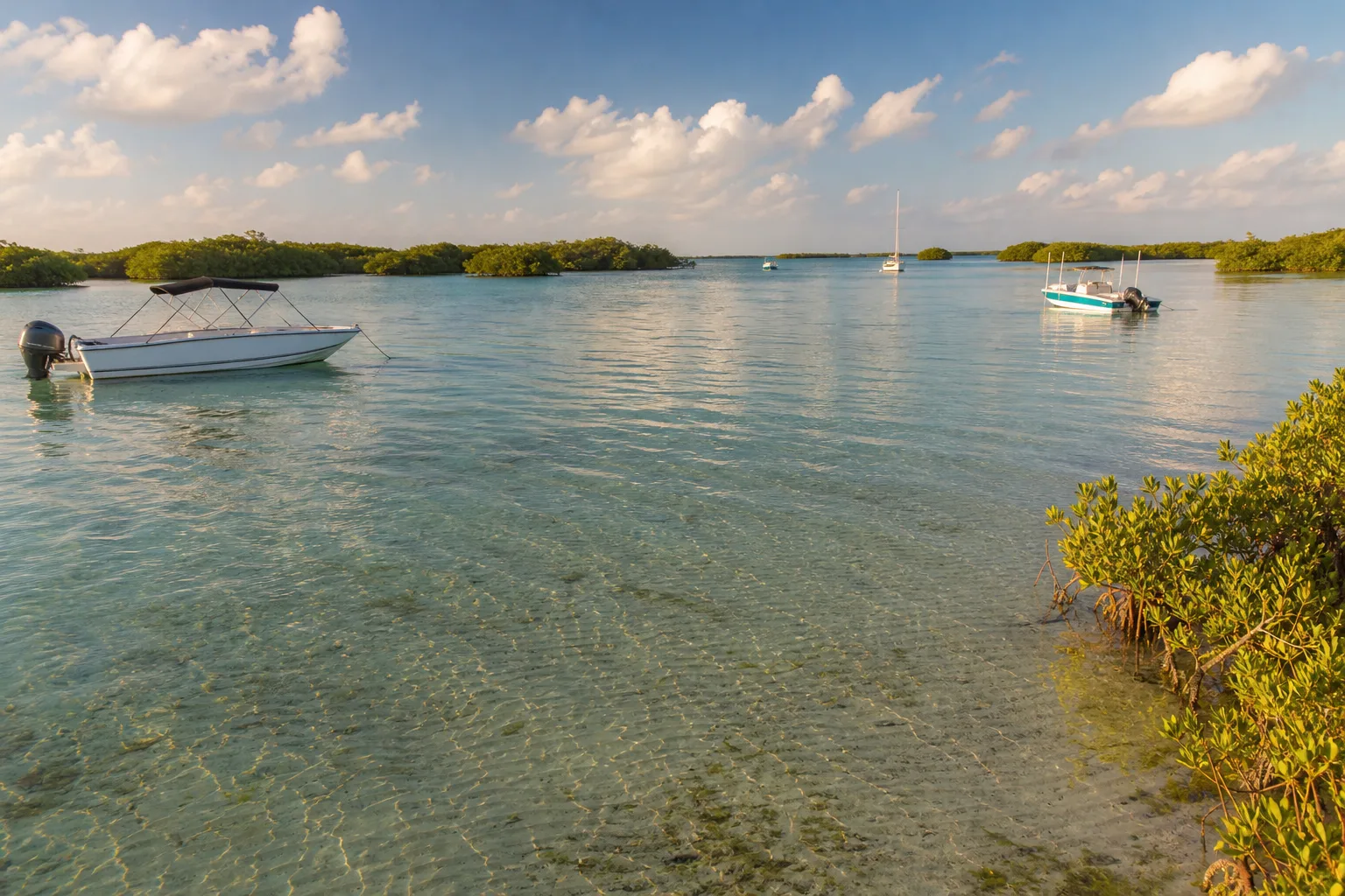
The Islamorada sandbar most boaters mean is the one off Whale Harbor on the Atlantic side, near mile marker 84 on the Overseas Highway, where boats anchor in very shallow water on a sand flat. It is reached only by boat or kayak, so you need a tide check, a chart and a plan for the Florida Keys National Marine Sanctuary rules that cover these waters.
Local boating guides call this spot the Whale Harbor sandbar, and a few others use the nickname of a nearby bar. We could not find an official government page that describes the sandbar, so treat the location here as a starting point and confirm it on a NOAA chart. Everything else in this guide, the sanctuary rules, the anchoring law, the ramps and the marinas, comes from official sources or Marinalo data from October 2026.
Where the Islamorada sandbar is
Islamorada is a village spread over six islands in the Florida Keys. The sandbar boaters talk about is just off the Whale Harbor area around mile marker 84, according to local charter guides, which report water depths from a few inches to about three feet. Those depths come from commercial guides, not NOAA, so rely on your own sounding and a chart rather than the numbers. Other flats and sandbars exist around the Keys, and some sit inside sanctuary zones where anchoring is not allowed.
Marinalo lists a Whale Harbor Marina among the Islamorada marinas; phone numbers and rates are below.
Tides: what to check first
Water depth over a Keys flat changes quickly. Marinalo does not have an Islamorada tide page, so use the closest pages in the Keys and treat them as a guide:
Both Duck Key and Marathon lie to the southwest of Islamorada, and times of high and low water shift from place to place along the Keys. On October 17, 2026 the Duck Key page showed a high of 1.3 feet and a low of 0.7 feet that day, which shows how small the range can be. On a sandbar that holds only a foot or two of water, even a half foot decides how close you can get. Marinalo's tide pages use NOAA harmonic constants and are not for navigation, so check NOAA predictions for the nearest station before you leave. To learn how to read the numbers, see how to read a tide chart and ebb, flood and slack tide.
Wind also moves water in shallow areas like Florida Bay and the Atlantic flats, so a steady wind can add or take away depth that the chart does not predict.
Florida Keys National Marine Sanctuary rules
Islamorada lies inside the Florida Keys National Marine Sanctuary. The sanctuary's regulations page lists rules that apply to everyday recreational boating:
| Topic | What the sanctuary says |
|---|---|
| Anchoring | A vessel may not be anchored on living coral. |
| Seagrass and bottom | Operating a vessel in a way that strikes or injures coral or seagrass, including prop scarring, is prohibited. |
| Speed near shore | Outside marked channels, a vessel may not exceed 4 knots (4.6 mph) and must make no wake within 300 feet of residential shorelines, stationary vessels or reef-marking aids. |
| Divers down flag | Idle speed and no wake within 300 feet of a divers-down flag. |
| Sewage and trash | Discharging treated or untreated sewage from marine sanitation devices, and trash, is prohibited sanctuary-wide. |
| Marked zones | Preservation and conservation areas are marked by yellow buoys. Wildlife management areas use white and orange spar buoys and may be idle speed, no motor, no anchor or no entry. |
The sanctuary notes that its anchoring ban in preservation areas and restoration areas "will not take effect until 2027," so read the current regulations page and the zone maps before an anchoring plan that relies on that date. The full text is in federal regulation 15 CFR Part 922, Subpart P.
Seagrass grows on many Keys flats, and prop scarring is specifically prohibited, so approach slowly with the motor trimmed up and stay in water deep enough for your draft.
State anchoring law
Florida Statute 327.4109 bars anchoring or mooring within 150 feet of a marina, boat ramp, boatyard or other launching and loading facility, and within 300 feet of the marked boundary of a public mooring field. Recreational fishing vessels whose occupants are actively tending hook-and-line gear are exempt, and the statute allows closer anchoring only for mechanical failure or dangerous weather. A violation is a noncriminal infraction. Marinas close to the sandbar mean you should measure distance, not guess.
We found no sandbar-specific county or FWC rule for the Islamorada sandbar. If you are unsure, call FWC or the Village of Islamorada before a first visit.
Marinas in Islamorada
Marinalo data from October 2026 lists 11 marinas on the Islamorada marinas page, 3 with a fuel dock. Only one has an official rate sheet: Plantation Yacht Harbor Marina at $240 per night for a 40-foot boat. The rest list rates on request.
| Marina | Phone | Rates | Fuel dock |
|---|---|---|---|
| Plantation Yacht Harbor Marina | 305-852-2381 | $240 per night, 40 ft | Yes |
| Caloosa Cove Resort & Marina | 305-664-8811 | On request | Yes |
| Snake Creek Marina | 305-396-7724 | On request | Yes |
| Whale Harbor Marina | 305-664-4511 | On request | Not listed |
| Bud n' Mary's Marina | 305-664-2461 | On request | Not listed |
For other fuel stops see the Florida fuel docks page. Marinalo prices are for a 40-foot boat, so call to confirm for your own length, or compare against Florida 40-foot slip prices.
Boat ramps and kayak launches
The Islamorada boat ramps page counts 2 trailer ramps and 5 paddle launches in the FWC Florida Boat Ramp Inventory, with 25 trailer spaces in total. The two ramps are:
- Plantation Yacht Harbor Marina at Founders Park, on Florida Bay: $40, 1 lane, 24 trailer spaces.
- Blackwood Road Dinghy Landing: free, 1 lane, 1 trailer space, and the inventory marks it as not recommended because there is no parking.
The paddle launches include Anne's Beach (east and west), Library Beach Park, Green Turtle Hammock Nature Preserve and Plantation Tropical Preserve. They are free in the inventory. The sandbar is a long paddle from some of them, so check distance and wind first, and read our guide to sit-on-top vs sit-in kayaks if you are choosing a boat. See all Florida kayak launches.
If your Keys trip also includes Key West, our Key West boating guide covers that end of the chain.
Practical tips for sandbar days
- Carry a chart and know where your draft puts you. Our skiff, bay boat and flats boat guide explains which hulls draw the least water.
- Tilt or trim up the motor near the flat, and keep the boat on plane only in the channel.
- Put out enough anchor line for a tide and wind change.
- Do not discard trash or sewage. Sanctuary rules prohibit it.
- Bring life jackets for everyone. See Coast Guard approved life jackets.
FAQ
Where is the Islamorada sandbar?
Local guides place it off the Whale Harbor area near mile marker 84, on the Atlantic side of Islamorada. Confirm the location on a NOAA chart before you go.
Can you anchor at the Islamorada sandbar?
Generally yes, away from coral, seagrass and marked zones, and outside the 150-foot limit around marinas and ramps set by Florida Statute 327.4109. Check the sanctuary zone maps.
What tide is best for the Islamorada sandbar?
A rising tide is safer, because the water is deepening. Marinalo has no Islamorada page, so use Duck Key or Marathon as a guide and confirm with NOAA.
Is the Islamorada sandbar inside a marine sanctuary?
Islamorada waters are inside the Florida Keys National Marine Sanctuary, so its rules on coral, seagrass, speed and discharges apply.
Where can I launch near Islamorada?
The inventory lists a trailer ramp at Plantation Yacht Harbor Marina at Founders Park and several free paddle launches. See the ramp page above.
Sources
- NOAA Florida Keys National Marine Sanctuary: regulations
- Florida Statutes, section 327.4109, Anchoring and mooring limits
- Wavve Boating: Quick Guide to Islamorada Sandbars (commercial guide, used only for the location and general depth range)
- Marinalo data, October 2026: Islamorada boat ramps (FWC Florida Boat Ramp Inventory)
- Marinalo data, October 2026: Islamorada marinas