
Toledo Bend Boating Guide: Texas Side
Toledo Bend boating guide for the Texas side: 51 ramps, 168.2 ft (86% full) on Oct. 17, 2026, Texas-Louisiana fishing rules, marinas in nearby towns, safety.
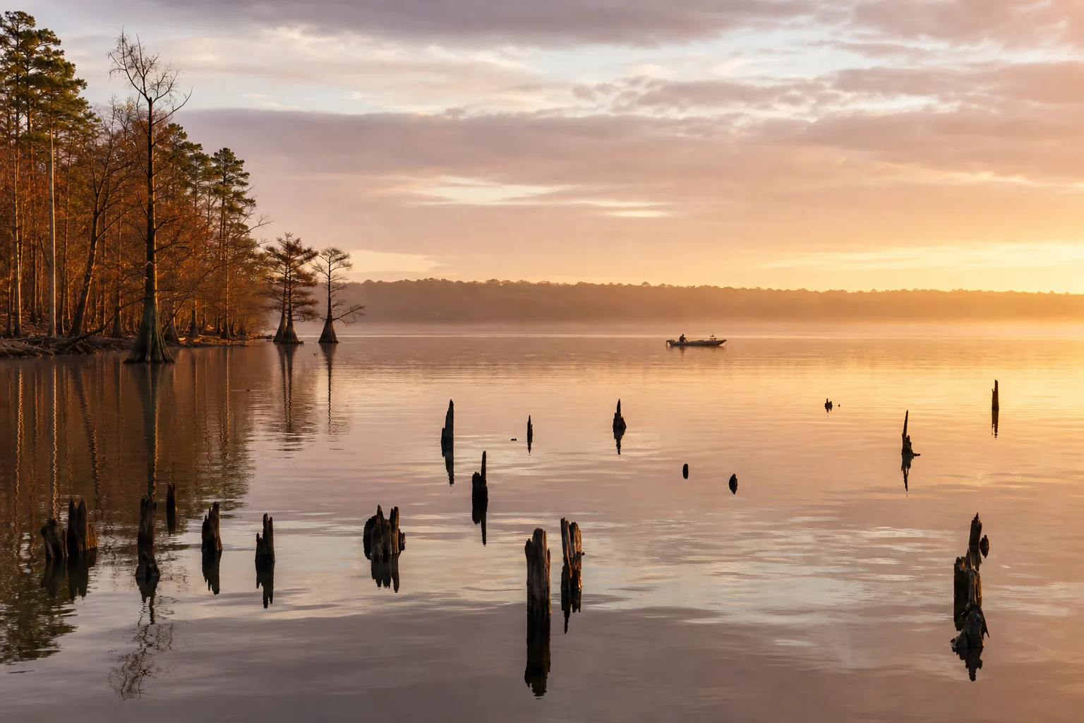
Toledo Bend Reservoir is a very large lake on the Sabine River that straddles the Texas-Louisiana state line, and Marinalo's page for it shows 51 public ramps and launches on the lake in the Texas Parks and Wildlife Department (TPWD) inventory. On October 17, 2026 it stood at 168.2 feet, 86% full against a full pool of 172 feet (Marinalo data, October 2026, from Texas Water Development Board readings).
This guide covers the Texas side: the size and shape of the lake, where the ramps are, what the current level means for launching, which marinas Marinalo lists in nearby towns, the rules that apply when you cross the state line and the safety habits that fit a big, timber-filled reservoir.
Toledo Bend at a glance
| Item | What the sources say |
|---|---|
| Location | On the Sabine River in Shelby, Sabine and Newton counties, straddling the Texas-Louisiana state line; the dam is in Newton County, about 24 miles northeast of Jasper (TPWD) |
| Surface area | 181,600 acres (TPWD) |
| Maximum depth | 110 feet (TPWD) |
| Impounded | 1967 (TPWD) |
| Conservation pool | 172 feet above sea level; fluctuation 1 to 5 feet (TPWD) |
| Water clarity | Clear in the middle and lower lake, slightly turbid in the upper region (TPWD) |
| Controlling authority | Sabine River Authority, Toledo Bend Division, Burkeville, Texas (409-565-2273) |
| Public ramps, Texas inventory | 51, via Marinalo |
The lake is shared between two states and managed through the Sabine River Authority. This guide sticks to what the Texas sources show; for the Louisiana side, check the Louisiana Department of Wildlife and Fisheries.
Access and ramps on the Texas side
Marinalo's Toledo Bend Reservoir page lists 51 open ramps and launches. Many are named simply "Toledo Bend Reservoir Boat Ramp," so Marinalo's page is best used as the map. The named entries include Harborlight Marina and Resort (two ramp entries), Indian Mounds Wilderness (two), more than a dozen Sabine National Forest entries, and Six Mile Public Boat Ramp, which Marinalo flags as free.
TPWD's access page for the north section of the lake gives more detail on several ramps operated by the Sabine River Authority of Texas (SRA) and by private concessions. A sample:
| Ramp | Operator | What TPWD says |
|---|---|---|
| Joaquin Public Ramp | SRA of Texas | Off US 84; two-lane ramp, not usable at low water; no fee listed |
| Swede Johnson Recreation Area | SRA of Texas | Off FM 139; one-lane ramp that accommodates all boat types; no fee listed |
| Tenaha Creek Ramp | SRA of Texas | Off FM 139; one-lane ramp, may not be usable at low lake levels; no fee listed |
| Bill's Landing | Private concession | One-lane ramp, may not be usable at low lake levels; fee required |
| Huxley Bay Marina | Private concession | Two-lane ramp handles all boat types; fee required |
| Bayou Siepe Ramp | SRA of Texas | End of FM 100A; one-lane ramp handles all boat types; fee required |
Fees and hours on that page can be out of date, so call the SRA at 409-565-2273 or the operator before you go. The SRA's own site lists Texas-side recreation areas including Swede Johnson, Bubba Cowser, Sam Forse Collins, Pendleton Park and Sabinetown, and has a lake-levels page.
Current level and low-water implications
Marinalo's lake page showed Toledo Bend at 168.2 feet on October 17, 2026, which is 86% full against 172 feet (Marinalo data, October 2026). The SRA's site on the same day showed a USGS gauge reading of 168.00 feet at 12:30 pm. That puts the lake about 4 feet below full pool, near the upper end of the 1 to 5 feet TPWD gives as normal fluctuation.
- Ramps: TPWD flags Joaquin as not usable at low water, and Tenaha Creek and Bill's Landing as possibly unusable at low lake levels. Ask the operator for the lowest level a ramp handles.
- Timber: TPWD says the lake has standing timber and flooded terrestrial vegetation. As water drops, hazards you cannot see at full pool come closer to the surface. Stay in marked channels where you can.
- Hydrilla: TPWD says non-native submersed plants, mainly hydrilla, dominate the vegetation. Check your prop and intake for fouling after running through beds.
- Where to check: the Marinalo lake page for Texas Water Development Board data and the SRA lake levels page.
Marinas and fuel
Marinalo has marina city pages for two towns near the Texas side of the lake, and none for Center:
| City page | Listings | Notes |
|---|---|---|
| Hemphill | Alpine Marina; Sandals and Spurs Resorts (rates on request) | Sabine County Chamber of Commerce is in Hemphill (TPWD) |
| Milam | Holly Park Marina and Motel (rates on request) | Call to confirm location and services |
I did not find a source stating that these businesses are on Toledo Bend, so treat them as marinas listed in lakeside cities. By contrast, TPWD names Huxley Bay Marina, and Marinalo's ramp list names Harborlight Marina and Resort, as lake locations. Marinalo lists no fuel docks in Hemphill or Milam as of October 2026, so ask any marina whether it sells fuel. The Texas fuel docks page covers fuel elsewhere in the state.
Rules, including Texas and Louisiana
Fishing across the state line
TPWD says residents of either state who are properly licensed in their state (or exempt because of age), and anyone holding a valid non-resident license from either state, may fish any portion of the lakes and rivers forming a common boundary between Louisiana and Texas, inland from a line across Sabine Pass. Fish landed in Texas must follow Texas bag and length limits. On Toledo Bend, limits for catfish, crappie, white bass and black basses apply on both the Texas and Louisiana portions of the lake, while regulations for some other species, including alligator gar, may differ.
TPWD also notes a fish consumption advisory is in effect for Toledo Bend. Check the Texas Department of State Health Services advisory before you keep fish for the table.
Boating rules
- Life jackets: on recreational vessels under 26 feet, every child under 13 must wear a U.S. Coast Guard-approved life jacket while underway (TPWD). See our life jacket guide.
- Boater education: required for anyone born on or after September 1, 1993 who operates certain vessels on Texas public waters. Check TPWD for the exact scope.
- Drain law: Texas law requires you to drain all water from your boat and trailer before leaving the vicinity of a freshwater lake. TPWD's Toledo Bend page lists no zebra mussel advisory, but the rule is statewide.
- Louisiana: if you launch from or travel into Louisiana waters, check the Louisiana Department of Wildlife and Fisheries for its boating rules.
Safety on a very big lake
- Plan for distance. With 181,600 acres, a run from one end to another is a big trip, so carry enough fuel and check the weather for the section you will actually be on.
- Stay out of standing timber unless you know the area, and keep the motor trimmed up in stump fields.
- Carry a VHF radio or fully charged phone. Our VHF marine radio guide explains how to use a radio.
- Know what to do if the boat goes over: what to do if your boat capsizes.
For comparison with other East Texas waters, see the Lake Fork guide and the Lake Livingston guide.
FAQ
How big is Toledo Bend?
TPWD lists 181,600 acres of surface area and a maximum depth of 110 feet.
Can I fish the Louisiana side with a Texas license?
TPWD says Texas and Louisiana residents with valid licenses from their own state may fish any portion of the shared boundary waters. Fish landed in Texas follow Texas limits.
What is the Toledo Bend water level now?
On October 17, 2026 it was 168.2 feet, 86% full against 172 feet (Marinalo data, October 2026). The SRA's gauge showed 168.00 feet at 12:30 pm that day.
How many public boat ramps are on the Texas side?
Marinalo's page, built on the TPWD inventory, lists 51 open ramps and launches in October 2026.
Who runs Toledo Bend?
The Sabine River Authority, Toledo Bend Division, according to TPWD.
Sources
- Marinalo data, October 2026: Toledo Bend Reservoir boat ramps, Marinas in Hemphill, Marinas in Milam
- TPWD: Fishing Toledo Bend Reservoir
- TPWD: Access to Toledo Bend Reservoir, north section
- TPWD: Requirements for Federal, State and Border Waters
- Sabine River Authority of Texas
- TPWD: Life Jackets and the water draining rule