
Amistad Reservoir Boating Guide: Ramps, Border Rules and Water Level
Amistad Reservoir boating guide: 15 public ramps, 1,060.7 ft (44.7% full) on Oct. 17, 2026, NPS lake use passes, border buoys and Mexico fishing rules.
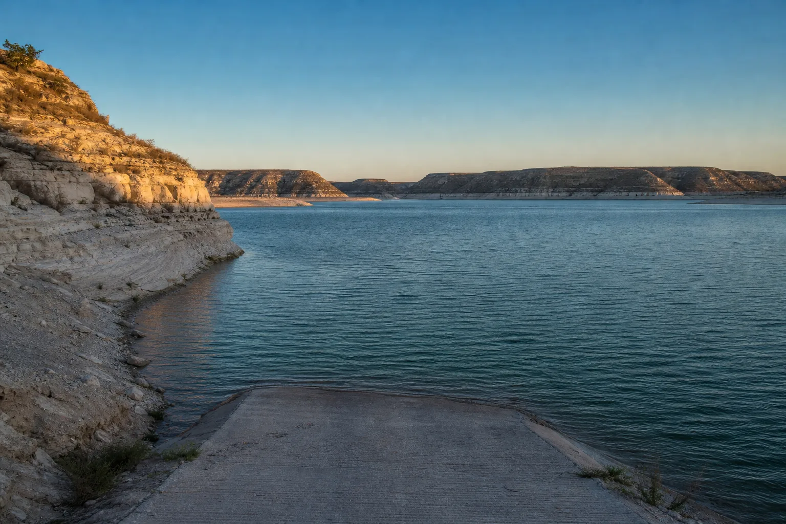
Amistad Reservoir is a Rio Grande reservoir near Del Rio, Texas, on the international border with Mexico, and its ramps are managed mostly by the National Park Service as part of Amistad National Recreation Area. On October 17, 2026 the lake stood at 1,060.7 feet, 44.7% full against a full pool of 1,117 feet (Marinalo data, October 2026, from Texas Water Development Board readings), which means many ramps are limited or closed.
This guide explains the double listing in the ramp data, which ramps the National Park Service showed as open, what the low water means, the lake use pass, the international boundary buoys, the Mexican fishing license rule and the safety basics.
Amistad at a glance
| Item | What the sources say |
|---|---|
| Location | On the Rio Grande, 12 miles northwest of Del Rio in Val Verde County (TPWD) |
| Surface area | 64,900 acres (TPWD) |
| Maximum depth | 217 feet (TPWD) |
| Impounded | 1969 (TPWD) |
| Conservation pool | 1,117 feet above sea level (TPWD) |
| Level fluctuation | Depends on rainfall and downstream irrigation demand; annual swings can be 5 to 10 feet, and the lake has dropped as much as 50 feet below conservation pool historically (TPWD) |
| Water clarity | Clear to slightly stained (TPWD) |
| Dam and level authority | International Boundary and Water Commission (IBWC), a joint U.S.-Mexico agency; the dam was completed in 1969 under the 1944 water treaty |
| Recreation manager | National Park Service, Amistad National Recreation Area |
The IBWC runs the dam and TPWD names it as the controlling authority for the reservoir. The Park Service runs the recreation area, which covers the ramps, campgrounds and lake use passes.
Access and ramps
The TPWD ramp inventory files ramps on this reservoir under two names, Lake Amistad and Amistad. Marinalo groups them on a single page, Lake Amistad boat ramps, with 15 entries, including Amistad National Recreation Area launches, 277 North Campground, Governors Landing Campground and Rough Canyon Recreational Area (Marinalo data, October 2026).
Some entries may describe the same facility. The Park Service names these main ramps: Diablo East, Rough Canyon, Box Canyon and Southwinds (U.S. Air Force) Marina, plus Black Brush Point, 277 North, 277 South, Spur 406, Spur 454 and the Pecos River. Note that the Del Rio ramp page on Marinalo lists Moore Park on San Felipe Springs, which is not on the reservoir.
Current level and what is open
At 1,060.7 feet on October 17, 2026 the lake was about 56 feet below full pool (Marinalo data, October 2026). The Park Service says it opens ramps as lake levels allow safe launching of trailered boats. Its conditions page, whose campground section was last updated October 15, 2026, showed this status when I checked:
| Ramp | Status on NPS conditions page |
|---|---|
| Rough Canyon Marina, low water ramp | Open, right side closed to all craft |
| Spur 406 | Open |
| Spur 454, low water ramp | Open |
| Diablo East | Closed |
| Box Canyon | Closed |
| Black Brush Point | Closed |
| Southwinds (U.S. Air Force) Marina | Closed |
| 277 North and 277 South | Closed |
| Pecos River | Closed |
| Rough Canyon Marina and Spur 454, high water ramps | Closed |
That chart changes with the lake, so treat it as a snapshot and check the Park Service page and call the park before you tow. For context, the Park Service says the reservoir set a historic low of 1,047.15 feet on July 17, 2024, when it was 24% full. Today's level is about 13.5 feet above that low and far below full pool.
What low water means for a boater
- Fewer launch options: plan a backup ramp, because several ramps are closed and some are open on one side only.
- Longer runs: the lake is deep (up to 217 feet), but shorelines move, so a route you know may be different now.
- Shoreline hazards: TPWD notes aquatic vegetation, mainly hydrilla, with coverage that depends on water level. Rocks and shoals closer to the surface are a risk at any reservoir when the level drops.
Lake use pass, fees and registration
The Park Service requires Amistad Lake Use Passes and charges a lake use fee for watercraft that require Texas registration. That means all motorized vessels and non-motorized vessels 14 feet or longer. Canoes, kayaks, punts, rowboats and rafts that are non-motorized are exempt, as are vessels under 14 feet that are paddled, poled, oared or windblown, and vessels over 115 feet. The park does not process registrations, which come from TPWD. Check the Park Service fees page for current amounts, which I did not verify.
Border rules: buoys, Mexican waters and fishing
The international boundary runs through the lake. The Park Service says it is marked by buoys numbered RG1 to RG28 that follow the historic Rio Grande channel. Texas boating rules apply on the U.S. side, and the lake use fee does not cover any fees Mexico requires on its side. The Park Service boating page does not explain crossing procedures, so ask the park before you cross the line.
For fishing, TPWD says all species on the Texas side are managed under statewide regulations. For anglers fishing Mexican waters, TPWD says a Mexican fishing license is required for everyone in the boat, and that Mexico boat permits are no longer required. TPWD's border waters page says the license, called a Permiso de Pesca Deportiva, is managed by the Mexican agency CONAPESCA and can be bought for a single day, a week, a month or a year. TPWD's lake page lists Del Rio shops that sell the licenses, but verify before you travel.
Marinas and fuel
Marinalo has no marina page for Del Rio, so there is no Marinalo marina list for this lake as of October 2026. The Park Service names Rough Canyon Marina and Southwinds (U.S. Air Force) Marina among its ramps, but this guide does not confirm slip availability or fuel at either. Ask the park or the marina directly. For fuel docks elsewhere in Texas, see the Texas fuel docks page.
Rules and safety
- Mussels: TPWD says zebra and quagga mussels have invaded Amistad. Texas law requires you to drain all water from your boat, livewells and trailer before leaving, and possessing or transporting these mussels is illegal. The Park Service also asks you to clean, drain and dry.
- Life jackets: on recreational vessels under 26 feet, every child under 13 must wear a U.S. Coast Guard-approved life jacket while underway (TPWD). The Park Service recommends that all passengers wear one. See our life jacket guide.
- Boater education: required for anyone born on or after September 1, 1993 who operates certain vessels on Texas public waters. Check TPWD for the exact scope.
- Weather: a big, open reservoir builds waves quickly in wind. Read our guide to special marine warnings and small craft advisories.
- Emergencies: know what to do if your boat capsizes.
FAQ
Is Lake Amistad the same as Amistad Reservoir?
Yes. TPWD files ramps under both names, and Marinalo lists all of them on one page with the same lake level.
What is the water level at Amistad now?
On October 17, 2026 it was 1,060.7 feet, 44.7% full against 1,117 feet (Marinalo data, October 2026).
Do I need a fishing license for Mexican waters?
Yes. TPWD says a Mexican fishing license is required for everyone in the boat, and the license is issued by CONAPESCA.
Do I need a lake use pass at Amistad?
The Park Service charges a lake use fee for watercraft that require state registration, which includes motorized boats and non-motorized boats 14 feet or longer.
Are there mussels in Amistad?
TPWD says zebra and quagga mussels have invaded the reservoir. Drain, clean and dry your boat.
Sources
- Marinalo data, October 2026: Lake Amistad boat ramps, Del Rio boat ramps
- TPWD: Fishing Amistad Reservoir
- National Park Service: Boating at Amistad National Recreation Area
- National Park Service: Amistad current conditions
- TPWD: Requirements for Federal, State and Border Waters
- IBWC: Amistad Dam fact sheet
- TPWD: Life Jackets and the water draining rule