
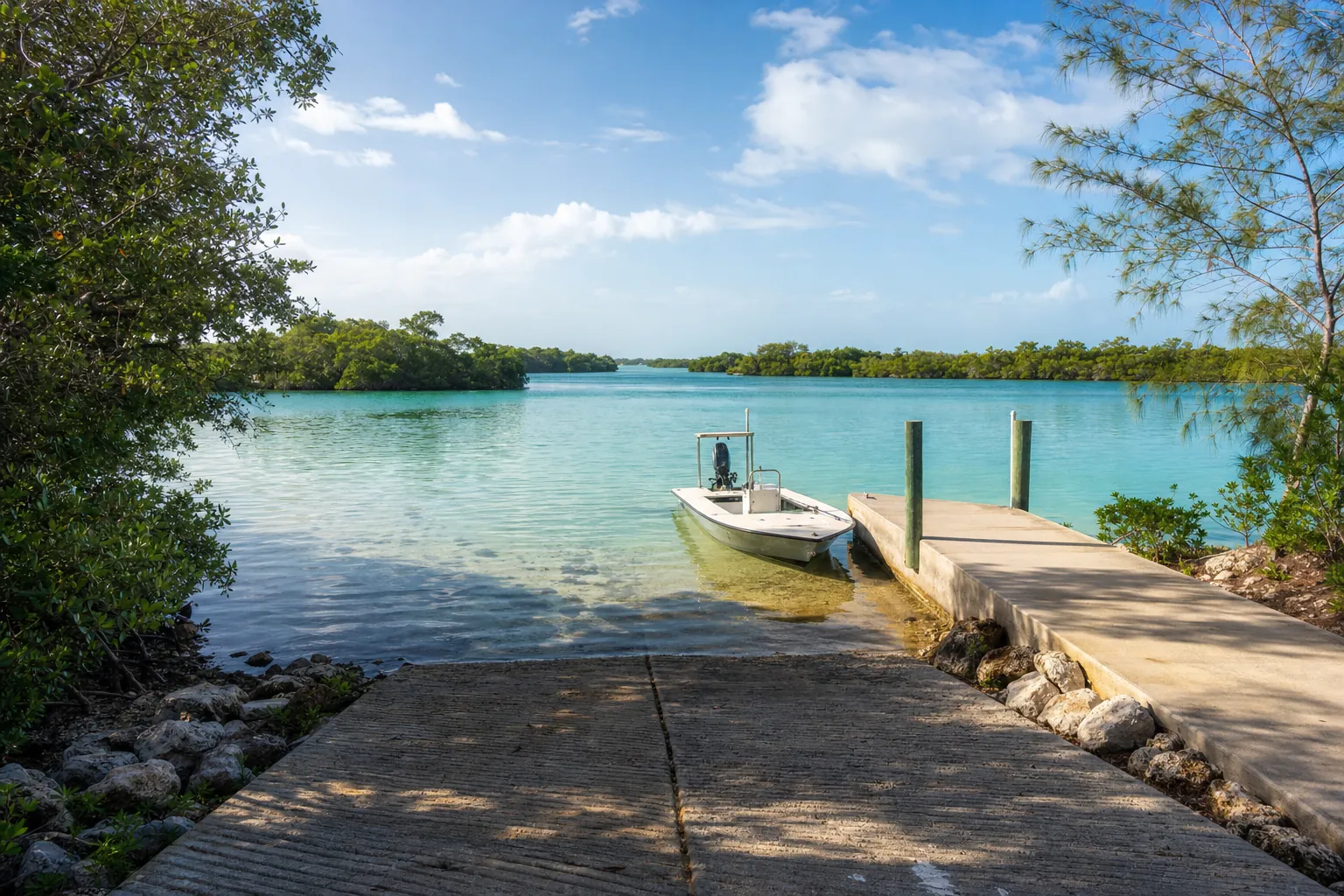
Boat ramp · Naples · Collier County
Collier Boulevard Boating Park
Addison Bay · Bay or lagoon · Salt or Brackish Water
Manatee protection zone on the water here
- Slow Speed (All Year) · Rule 68C-22.023(2)(c)12.
State zones from the FWC. Federal and local speed zones can also apply: follow the posted signs.
Florida FWC boat ramp inventory
About Collier Boulevard Boating Park

About this ramp
Collier Boulevard Boating Park is a boat ramp in Naples, Collier County on Addison Bay, a bay or lagoon with salt or brackish water. It is publicly owned and open to everyone and managed by Collier County.
Launching
The ramp has 2 lanes with a concrete surface. The FWC rates its condition as good to excellent. There is a staging dock.
Fees, parking and hours
The launch fee is $4 per day. Pay at the drop box on site. Parking: 86 trailer spaces and 3 car spaces, paved - asphalt or concrete. Hours: Sunrise to Sunset.
Facilities
Restrooms: No Toilet. Accessibility: Low Level of Accessibility.
Notes from the FWC
Restrooms are available across the street at neighboring Isles of Capri Padlecraft Park. You have to drive there.
Fishing
24 artificial reefs within 10 miles of the ramp, from the FWC artificial reef program.
Caxambas Pass 2.5 Mile
4.6 mi
- Depth
- 24 ft
- GPS
- 25° 55.920' N, 81° 45.20' W
- Material
- Pilings
Caxambas Pass 2.5 Mile
5.2 mi
- Depth
- 24 ft
- GPS
- 25° 55.80' N, 81° 46.00' W
- Material
- Culverts
Marco Island 2 Mile Reef
5.4 mi
- Depth
- 21 ft
- Relief
- 3 ft
- GPS
- 25° 55.395' N, 81° 45.764' W
- Material
- Dredge Pipe
Marco Island 2 Mile Reef
5.4 mi
- Depth
- 21 ft
- Relief
- 5 ft
- GPS
- 25° 55.396' N, 81° 45.783' W
- Material
- Rubble
Show all 24 reefs
| Reef | Distance | Depth | GPS |
|---|---|---|---|
| Caxambas Pass 2.5 Mile | 4.6 mi | 24 ft | 25° 55.920' N, 81° 45.20' W |
| Caxambas Pass 2.5 Mile | 5.2 mi | 24 ft | 25° 55.80' N, 81° 46.00' W |
| Marco Island 2 Mile Reef | 5.4 mi | 21 ft | 25° 55.395' N, 81° 45.764' W |
| Marco Island 2 Mile Reef | 5.4 mi | 21 ft | 25° 55.396' N, 81° 45.783' W |
| Marco Island 2 Mile | 5.7 mi | 23 ft | 25° 55.449' N, 81° 46.213' W |
| Marco Island 2 Mile | 5.7 mi | 22 ft | 25° 55.436' N, 81° 46.236' W |
| Marco Island 2 Mile Reef | 5.7 mi | 23 ft | 25° 55.434' N, 81° 46.236' W |
| Marco Pass Reef Site | 5.7 mi | 22 ft | 25° 55.40' N, 81° 46.250' W |
| Marco Island 2 Mile | 6.0 mi | 22 ft | 25° 55.821' N, 81° 46.965' W |
| Keewaydin 3 Mile #1 | 8.7 mi | 27 ft | 26° 02.034' N, 81° 49.787' W |
| Keewaydin 3 Mile, C & D Reef 01 | 8.8 mi | 28 ft | 26° 02.090' N, 81° 49.850' W |
| Keewaydin 3 Mile #2 | 8.8 mi | 27 ft | 26° 02.109' N, 81° 49.852' W |
| Keewaydin 3 Mile, C & D Reef 02 | 8.8 mi | 28 ft | 26° 02.184' N, 81° 49.859' W |
| Keewaydin 3 Mile #3 | 8.9 mi | 27 ft | 26° 02.169' N, 81° 49.899' W |
| Keewaydin 3 Mile #4 | 8.9 mi | 27 ft | 26° 02.226' N, 81° 49.969' W |
| Collier 5 Mile Reef | 9.8 mi | 31 ft | 25° 51.826' N, 81° 47.633' W |
| Marco Island 5 Mile Reef | 9.8 mi | 31 ft | 25° 51.931' N, 81° 47.819' W |
| Marco Island 5 Mile Reef | 9.8 mi | 31 ft | 25° 51.816' N, 81° 47.648' W |
| Marco Island 5 Mile Site | 9.8 mi | 32 ft | 25° 51.898' N, 81° 47.788' W |
| Collier 5 Mile Reef | 9.8 mi | 31 ft | 25° 51.896' N, 81° 47.788' W |
| Marco Island 5 Mile Reef | 9.9 mi | 30 ft | 25° 51.931' N, 81° 47.872' W |
| Caxambas Pass 5.0 Mile | 9.9 mi | 30 ft | 25° 51.788' N, 81° 47.664' W |
| Marco Island 5 Mile Reef | 10.0 mi | 30 ft | 25° 51.884' N, 81° 47.971' W |
| Marco Island 5 Mile Reef | 10.0 mi | 30 ft | 25° 51.776' N, 81° 47.868' W |
Source: Florida Fish and Wildlife Conservation Commission (FWC). Check fishing license and bag limit rules before you go.
Nearby
Source: Florida Fish and Wildlife Conservation Commission (FWC), Florida Boat Ramp Inventory. Check local signs for current fees and hours.