
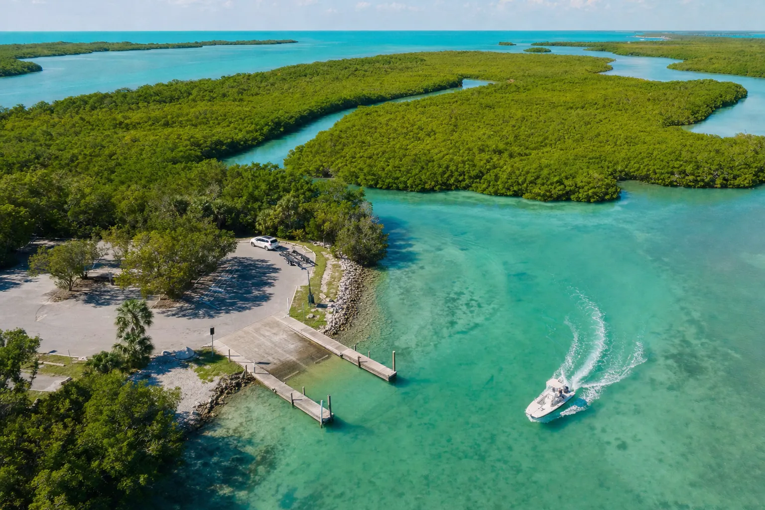
Boat ramp · Panama City · Bay County
Bob George Park Public Boat Ramp
St. Andrew Bay - Watson Bayou · Bay or lagoon · Salt or Brackish Water
Small lot: only 4 trailer spaces. On weekends and holidays, arrive early or keep a second ramp in mind.
Florida FWC boat ramp inventory
About Bob George Park Public Boat Ramp

About this ramp
Bob George Park Public Boat Ramp is a boat ramp in Panama City, Bay County on St. Andrew Bay - Watson Bayou, a bay or lagoon with salt or brackish water. It is publicly owned and open to everyone and managed by City of Panama City.
Launching
The ramp has 1 lane with a concrete surface. The FWC rates its condition as good. There is a fixed dock.
Fees, parking and hours
Launching is free. Parking: 4 trailer spaces and 4 car spaces, not paved - gravel/limestone/packed soil. Hours: 24 Hours. Small lot: only 4 trailer spaces. On weekends and holidays, arrive early or keep a second ramp in mind.
Facilities
Restrooms: No Toilet. Amenities: picnic.
Fishing
26 artificial reefs within 10 miles of the ramp, from the FWC artificial reef program.
Life Boats (Bay)
5.2 mi
- Depth
- 25 ft
- GPS
- 30° 06.948' N, 85° 42.347' W
- Material
- Lifeboats
Spanish Shanty Barge (Bay)
5.2 mi
- Depth
- 20 ft
- GPS
- 30° 06.706' N, 85° 42.246' W
- Material
- Barge 150'
B & B Reef
6.9 mi
- Depth
- 43 ft
- Relief
- 6 ft
- GPS
- 30° 04.928' N, 85° 42.878' W
- Material
- Barge
Navy Barge
6.9 mi
- Depth
- 42 ft
- GPS
- 30° 04.455' N, 85° 42.365' W
- Material
- Barge
Show all 26 reefs
| Reef | Distance | Depth | GPS |
|---|---|---|---|
| Life Boats (Bay) | 5.2 mi | 25 ft | 30° 06.948' N, 85° 42.347' W |
| Spanish Shanty Barge (Bay) | 5.2 mi | 20 ft | 30° 06.706' N, 85° 42.246' W |
| B & B Reef | 6.9 mi | 43 ft | 30° 04.928' N, 85° 42.878' W |
| Navy Barge | 6.9 mi | 42 ft | 30° 04.455' N, 85° 42.365' W |
| MC Comick Barge | 6.9 mi | 60 ft | 30° 04.446' N, 85° 42.360' W |
| Loss Pontoon Site - Hath | 7.2 mi | 52 ft | 30° 05.034' N, 85° 43.297' W |
| Mooring Buoy Site - 331 | 7.3 mi | – | 30° 04.941' N, 85° 43.394' W |
| Loss Pontoon #3 | 7.5 mi | – | 30° 05.337' N, 85° 43.920' W |
| Wet And Wild Site - 331 | 7.7 mi | – | 30° 05.373' N, 85° 44.202' W |
| Navy Barge | 7.7 mi | 48 ft | 30° 05.00' N, 85° 43.940' W |
| Buoy Barge | 7.7 mi | 60 ft | 30° 05.003' N, 85° 43.948' W |
| Dan Barge | 7.7 mi | 60 ft | 30° 04.838' N, 85° 43.843' W |
| Loss Pontoon Site | 7.9 mi | 65 ft | 30° 04.968' N, 85° 44.116' W |
| Midway Site - Tires | 9.0 mi | 70 ft | 30° 02.70' N, 85° 43.175' W |
| Midway Site - Tires | 9.0 mi | – | 30° 02.687' N, 85° 43.192' W |
| Smith Barge Site - 331 Bridge | 9.2 mi | – | 30° 04.836' N, 85° 45.594' W |
| Midway Site - 331 Bridge | 9.3 mi | – | 30° 02.537' N, 85° 43.462' W |
| USS Strength | 9.3 mi | 77 ft | 30° 01.943' N, 85° 42.512' W |
| Hathaway Span #1 - Midway Site | 9.4 mi | 72 ft | 30° 02.690' N, 85° 43.745' W |
| Midway Site | 9.4 mi | 70 ft | 30° 02.392' N, 85° 43.359' W |
| Midway Original Site | 9.4 mi | 74 ft | 30° 02.353' N, 85° 43.302' W |
| Midway Site Boxcars | 9.4 mi | 72 ft | 30° 02.355' N, 85° 43.335' W |
| Midway Site - Tires | 9.5 mi | 71 ft | 30° 02.282' N, 85° 43.407' W |
| Davis Barge | 9.8 mi | 55 ft | 30° 00.454' N, 85° 36.472' W |
| Hathaway Span #2 -Midway Site | 9.8 mi | 70 ft | 30° 02.197' N, 85° 43.707' W |
| Loss Pontoon | 10.0 mi | 66 ft | 30° 00.891' N, 85° 41.477' W |
Source: Florida Fish and Wildlife Conservation Commission (FWC). Check fishing license and bag limit rules before you go.
Nearby
Other ramps nearby
Source: Florida Fish and Wildlife Conservation Commission (FWC), Florida Boat Ramp Inventory. Check local signs for current fees and hours.